Digital Earth Africa recently hosted ESRI during one of the weekly virtual training and knowledge-sharing sessions that Digital Earth Africa presents each week. These sessions are open to anyone to attend; from users and would-be users of Digital Earth Africa's platform and services, to policy- and decision-makers involved in the sustainable management of our continent's natural resources.
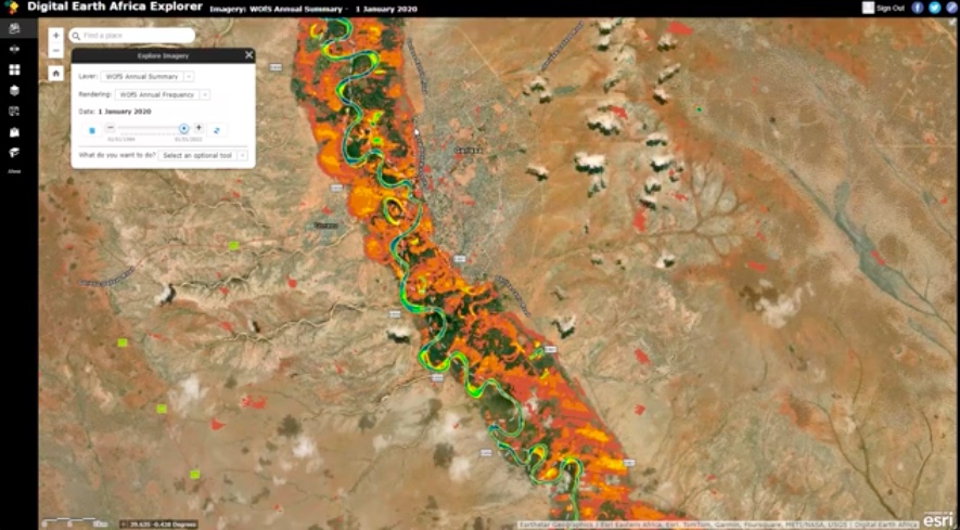
ESRI used the session as an opportunity to demonstrate how participants can freely access DE Africa’s continental products and services such as Water Observations from Space (WOfS) and other data through the ESRI's Africa GeoPortal. This approach not only diversifies user interfaces but also strengthen synergies between ESRI and DE Africa and the shared goal of supporting action towards meeting towards meeting the Sustainable Development Goals (SDGs) through open access to Earth Observation data.
ESRI provided a practical demonstration on the session on how to use Digital Earth Africa's tools - via the Africa GeoPortal - to help monitor floods.
Watch the video, in English, here: https://www.youtube.com/watch?v=D8iENRssFKk
Overview of Africa GeoPortal
The Africa GeoPortal was established to break down barriers to geospatial technology and foster innovation in Africa. It provides access to a wide range of data, geospatial tools, and tutorials, sourced from global contributors, regional partners, and national governments. The portal follows a systems approach to minimize duplication and reduce its carbon footprint. By harnessing the power of geospatial technology, the Africa GeoPortal is transforming the way users access and analyze data, ultimately contributing to a better Africa.
Data and Available Tools
The Africa GeoPortal offers three main pillars: data, capabilities, and a learning center. Users can access a variety of data sets, including those from ESRI's Living Atlas and regional contributors, including Digital Earth Africa. The portal also provides geospatial tools for creating maps, performing spatial analysis, and developing applications such as dashboards and story maps. The learning center offers tutorials and lessons to help users get started or advance their skills in GIS and geospatial technology.
Exploring Africa GeoPortal and its applications
Users can create maps, web maps, and web scenes, and share them with others. The GeoPortal includes application templates to provide interactive experiences, as well as tools for creating story maps, which combine maps, media, and text to provide a narrative context. Users can also access the Digital Earth Africa Explorer, which allows them to explore imagery and perform change detection.
Real world examples
Several use cases were demonstrated during the session, showcasing the GeoPortal's capabilities. Examples included comparing the extent of Lake Sulu in Tanzania over time, analyzing land use changes in Ghana, and using the Streamflow Forecasting Viewer to predict stream flow up to eight days ahead. The GeoPortal also demonstrated how it can analyze flood impacts in Kenya, providing insights into the extent of flooding and the number of affected households.
The Africa GeoPortal is a powerful tool that is revolutionizing the way users access and analyze geospatial data in Africa. By providing access to a wide range of data, tools, and tutorials, the portal is empowering users to make informed decisions and drive positive change across the continent. The session concluded with information on upcoming sessions in French and Arabic, emphasizing the portal's role in supporting community engagement and informed decision-making.
Link to Africa GeoPortal https://www.africageoportal.com
Free online courses: https://learn.digitalearthafrica.org
Other services: https://www.digitalearthafrica.org/platform-resources/services
DE Africa host weekly live sessions every Wednesday at 11am GMT zero, alternating between English and French. To be part of the experience, please register at: https://bit.ly/DEAfricaLiveSessions