Mangroves are an ecological treasure, thriving in coastal regions and serving as vital habitats for wildlife, natural protectors against soil erosion, and economic lifelines for communities. However, their existence is under increasing threat due to human activity, rising sea levels, and coastal erosion. Recognising the critical importance of mangroves, FarmCom, based in Kilifi, Kenya, has taken on the ambitious task of restoring mangrove ecosystems and empowering local youth to take charge of their environment.
With support from Digital Earth (DE) Africa, FarmCom participants are now learning to harness the power of earth observation tools to monitor and rejuvenate these natural coastal assets. A recent training session highlighted how data can become an invaluable conservation tool and marked another step forward in connecting science with community-based action.
Community action for environmental conservation
Kilifi, located on the coast of Kenya, has a rich stretch of mangroves, but the area’s history tells a story of exploitation. Once harvested heavily for export, the mangroves faced severe deforestation until government intervention. Recent years have seen an emphasis on restoration programmes in Kilifi County, aligning conservation efforts with sustainable livelihood development.
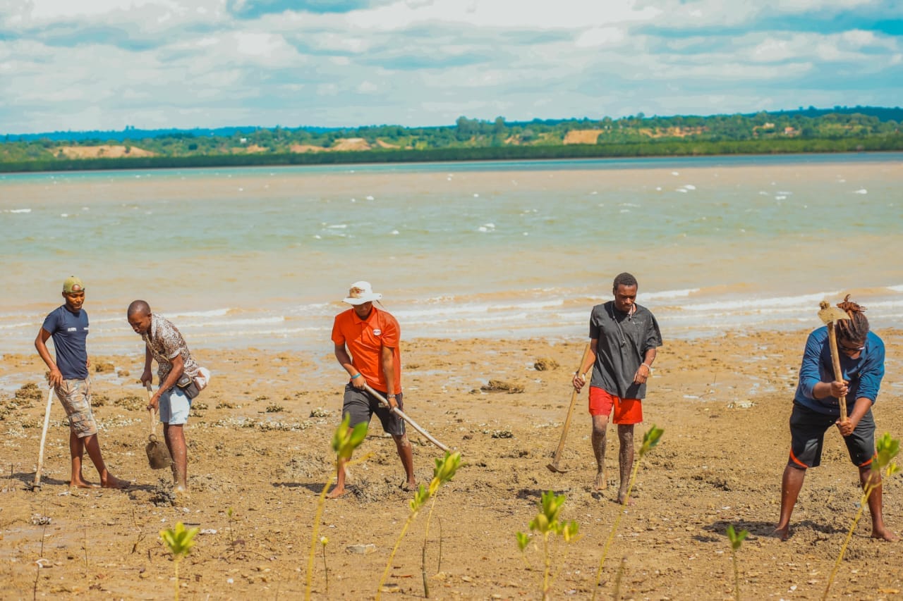
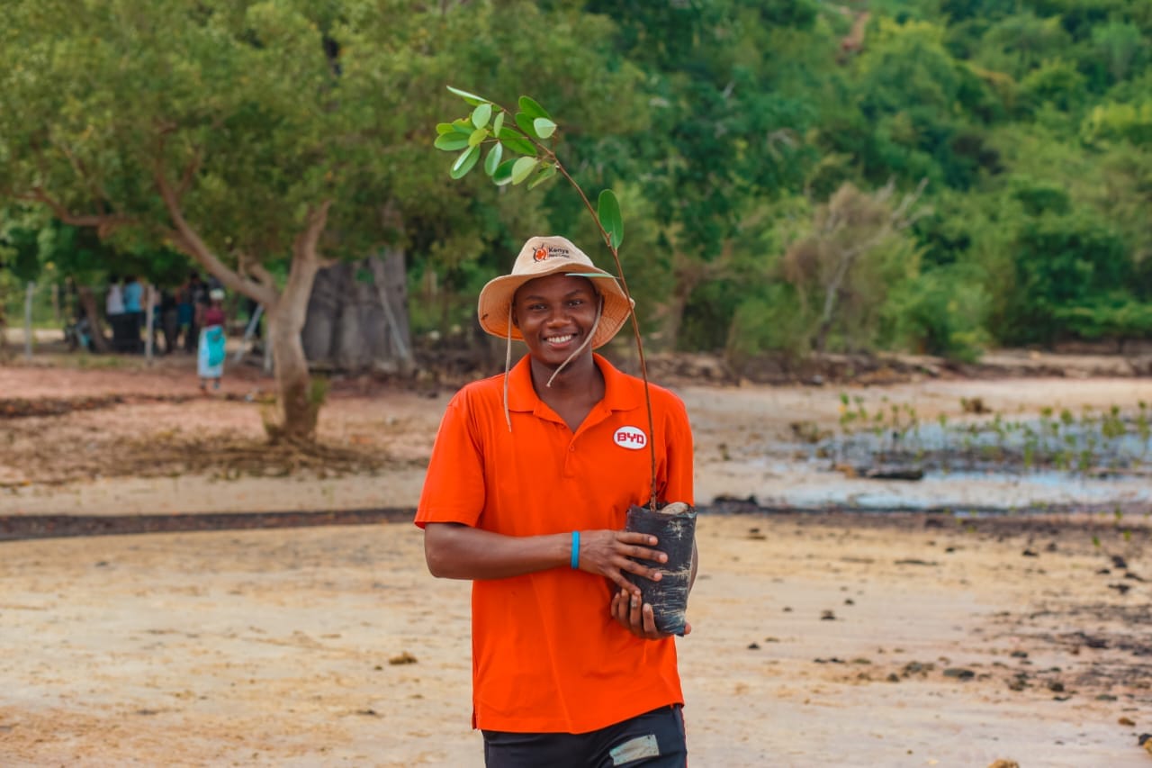
FarmCom has been at the heart of this movement, engaging local youth in reforestation efforts. Silas Mwambegu from FarmCom says, “It is our responsibility to protect our oceans, our wildlife, our habitat, and our planet. We’re building a future where the community protects their own environment while creating opportunities to thrive.” By planting mangroves and raising environmental awareness, FarmCom mobilises university students and young women to lead conservation efforts.
Mangrove nurseries in Kilifi are managed and owned by the local community. This model ensures long-term stewardship and has even opened up income opportunities. Women harvest mangrove seedlings during the planting season, which are sold as part of the reforestation programme.

The benefits of restoring these extraordinary ecosystems extend far beyond sustainability. From acting as natural windbreakers to trapping ocean-borne plastic waste and sheltering endangered species, mangroves represent an essential intersection between livelihoods and environmental resilience. For communities facing the devastating effects of drought, they also act as stabilising agents, making food security initiatives in the region more feasible.
The role of earth observation in preserving mangroves
The latest collaboration between FarmCom and DE Africa marks an exciting leap in the role of data for conservation. Through training workshops, community members were introduced to DE Africa’s Map and Sandbox platforms, which provide tools to conduct impactful data analysis. Participants learned how to monitor coastal erosion, trace changes over time with the Coastlines Monitoring Service dashboard, and assess mangrove ecosystems systematically.
Accessing earth observation data empowers FarmCom to target their reforestation efforts even more precisely. For instance, satellite analysis can help determine the best areas to plant mangroves by assessing environmental variables such as salinity. It also offers the opportunity to track historical rainfall patterns, equipping agricultural communities with insights into when, where, and what crops to plant.
Although the process is still in its early days, there is a strong sense of optimism. Gabriel Itote, a program officer at the Jijenge youth initiative who is involved with Farmcom says, “Accessing geospatial data can be very beneficial for us. We need the time to master Digital Earth Africa and experiment in the sandbox environment, but as time goes by and we become more fluent in its application, we will be able to harness the huge benefit that DE Africa offers.”
Connecting with global conservation efforts
FarmCom’s initiative ties into a broader vision seen across Africa and beyond—leveraging earth observation data to achieve environmental and developmental goals. For example, in Zanzibar, Digital Earth Africa’s training work has enabled researchers to assess mangrove coverage in Chwaka Bay and Makoba Bay, observing trends and working closely with local stakeholders to develop effective management plans.
Using satellite imagery and vegetation indices such as NDVI (Normalised Difference Vegetation Index), the Zanzibar project showcased measurable improvements in mangrove conservation. This type of data insight not only informs decision-making but mobilises various institutions to collaborate on managing natural ecosystems sustainably.
Dr Kenneth Mubea, the Capacity Development Lead at DE Africa says, “Earth observation tools have the power to connect high-level science with grassroots action. It’s incredible to see how communities like those in Kilifi are starting to integrate these resources into their conservation practices. These types of initiatives create lasting impacts, both environmentally and socially.”
FarmCom’s efforts in Kilifi and the success of initiatives like the one in Zanzibar highlight the power of collaboration and innovation in tackling environmental challenges. By helping communities understand the importance of conservation and equipping them with tools like earth observation data, projects like these demonstrate that meaningful change begins with empowering people.
The impact of this community-led conservation is already visible, but the potential for growth and transformation in Kilifi and beyond is immense. With tools like DE Africa’s platforms and the unstoppable spirit of local changemakers, the preservation of mangroves may yet tell a new story—one of renewal, resilience, and an environmentally sustainable future.