 Inglês
  Português
  Francês
  العربية
 Digital Earth África
Water Quality Monitoring Service
Understanding the Condition of Africa’s Water Bodies
The Digital Earth Africa Water Quality Monitoring Service delivers harmonised, satellite-derived water quality information for lakes, dams and reservoirs across the African continent. Building on the Waterbodies Monitoring Service, which maps the extent and dynamics of more than 700,000 water bodies, the Water Quality Monitoring Service advances from identifying where water is, to understanding what condition it is in.
Using a sensor-agnostic approach that integrates multiple satellite missions and published water quality algorithms, the service provides consistent, comparable data from 2000 to the present at 10 metre spatial resolution.
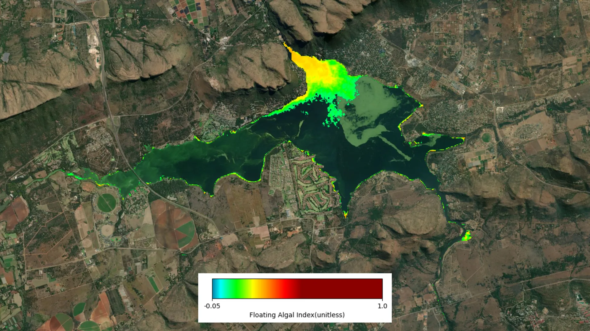
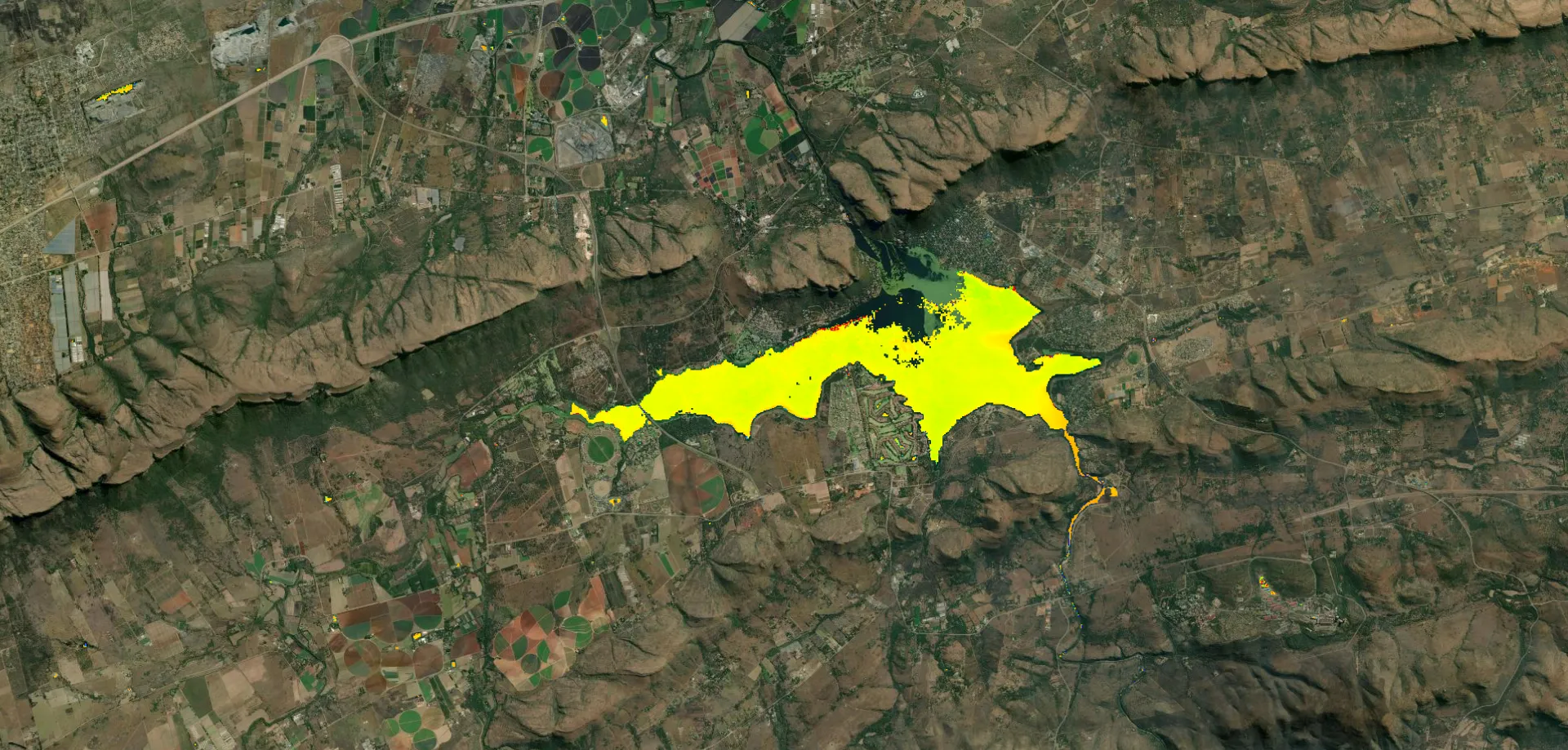
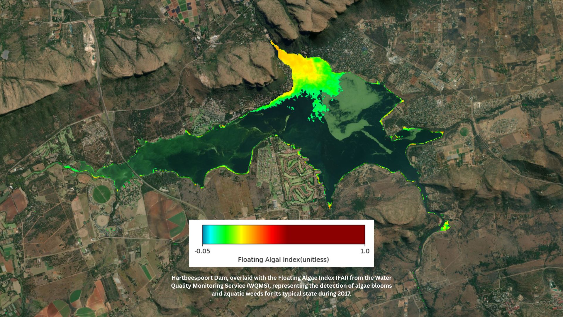
Hartbeespoort Dam, overlaid with the Floating Algae Index (FAI) from the Water Quality Monitoring Service (WQMS), representing the detection of algae blooms and aquatic weeds for its typical state during 2017.
Caraterísticas principais
Multi-Decadal Baseline
Annual continental water quality characterisation from 2000 to 2024 at 10 metre spatial resolution, establishing a long-term record for understanding change in condition over time.
Comprehensive Water Quality Indicators
The service describes key water quality parameters including water surface temperature, water colour, optical water type, floating algae and algal bloom indicators, trophic state (generalised chlorophyll-a levels), and turbidity.
Sensor-Agnostic, Multi-Mission Approach
By integrating data from multiple satellite missions using published algorithms, the service maximises data availability and ensures continuity and consistency through time.
Configurable Alerts — coming soon
Future phases will introduce alert functionality to notify users when defined water quality thresholds are exceeded for specific water bodies.
Access the Service
The Water Quality Monitoring Service is accessible through multiple DE Africa platforms:
Mapa de África da Digital Earth
Data Catalogue
Guia do utilizador
Applications of the Water Quality Monitoring Service
The Water Quality Monitoring Service is designed to support water resource management authorities, environmental monitoring agencies, and government departments across Africa. It also informs the public health sector and agricultural activities including livestock and fisheries where water quality conditions are critical yet information is scarce.
Aplicações
Water Resource Management
Provides resource managers and government departments with regularly updated, standardised information on the condition of surface water bodies, supporting planning and operational decision-making.
Environmental Monitoring and SDG Reporting
Directly supports national reporting against SDG Indicator 6.6.1, which tracks changes in water-related ecosystems over time, offering transparent, higher-resolution approaches adaptable to national contexts.
Public Health and Agricultural Planning
In extreme cases, harmful algal blooms and cyanobacteria pose direct risks to human and animal health. The service enables early identification of conditions associated with these risks, informing public health responses and agricultural water use decisions.
Long-Term Trend Analysis
A multi-decadal baseline from 2000 enables governments and institutions to understand long-term water quality trends, assess the impact of climate variability and land use change, and shift from reactive responses to proactive, evidence-based management.
“Africa’s freshwater systems are under increasing pressure from climate variability, land use change and pollution. With the launch of the Water Quality Monitoring Service, we are providing a long-term, standardised and regularly updated dataset across the entire continent, moving from fragmented monitoring to open, operational water intelligence.”
Dr Lisa-Maria Rebelo, Managing Director, Digital Earth Africa
Casos de utilização relacionados
Março 25, 2026
Digital Earth Africa Launches Continental Water Quality Monitoring Service to Strengthen Evidence-Based Water Management

Março 5, 2026
Championing the next generation of African geospatial talent: A conversation with Nancy Wayua