 Inglês
  Português
  Francês
  العربية
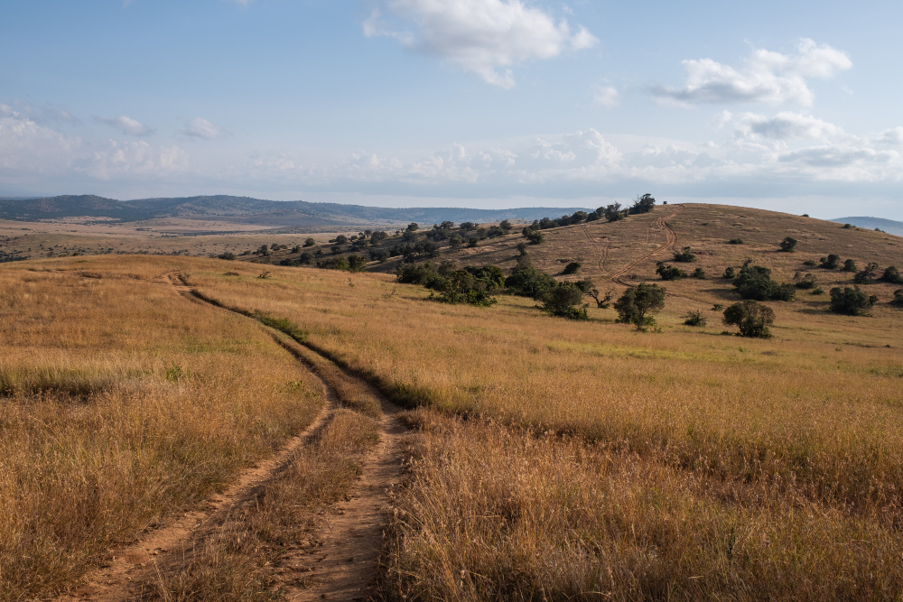
In Kenya’s arid and semi-arid north, where livelihoods depend on healthy rangelands and reliable water, conservation managers need reliable data. The Isiolo County Conservancies Association (ICCA) is putting Earth observation analytics to work to close the information gap and protect the land and people that depend on it.
The Challenge: Managing Rangelands Without Reliable Data
Across Isiolo County and across much of the Horn of Africa conservancy managers, pastoralists, and policymakers face a persistent challenge: they must make critical land management decisions with limited, often outdated environmental data. Rainfall is unpredictable, vegetation cover fluctuates dramatically between seasons, and the relationship between climatic conditions and land health is rarely straightforward.
When vegetation fails to respond to adequate rainfall, the cause may not be climate at all. It may signal deeper governance challenges, management failures, or the impact of conflict on land use. Without spatial data to separate these factors, targeted responses are impossible.
The Isiolo County Conservancies Association which brings together community conservancies across one of Kenya’s most ecologically significant and climate-vulnerable regions recognised that evidence-based decision-making required a new kind of tool.
The Tool: Earth Observation Analytics for Conservancy Managers
The Conservancy Analytics and Dashboard, developed using data and infrastructure provided by Digital Earth Africa, offers conservancy managers access to analysis-ready Earth observation data tailored to the rangelands of northern Kenya. The tool monitors fractional land cover, tracks rainfall and rainfall anomalies, and enables users to interrogate the relationship between vegetation condition and precipitation over time.
For ICCA, the ability to overlay vegetation greenness indicators with rainfall data is transformative. Abdilatif Boru, CEO of ICCA, describes the potential clearly:
“If rainfall is good but vegetation remains poor, this signals governance or management gaps. That is the kind of insight that changes how we respond on the ground.”
The tool’s analytical displays and data download functions are already supporting conservancy managers across Isiolo in shifting from intuition-based to evidence-based decision-making which is a critical step for communities operating in one of Africa’s most climate-exposed landscapes.
From Monitoring to Action: How ICCA Is Using the Data
ICCA has identified a range of high-priority applications for the analytics tool, each linked to a core challenge facing the conservancies it supports.
- Intervention monitoring: Tracking greenness and land cover change before and after rangeland interventions to generate evidence of impact.
- Conflict and governance analysis: Using spatial data to understand how conflict dynamics or co-management structures affect rangeland health across conservancy boundaries.
- Theory of change validation: Applying vegetation trend data to demonstrate measurable progress toward conservation objectives and strengthen the evidence base for donor reporting.
- Fundraising and advocacy: Leveraging visualised trend data to build compelling, data-backed proposals for funders and policymakers.
- Livelihoods expansion: Extending the tool’s application beyond vegetation monitoring into broader pastoralist livelihood indicators while recognising that land health and human wellbeing are inseparable.
This breadth of application reflects ICCA’s ambition to make Earth observation data a routine part of conservancy embedded across all programmes.
Building a Data Ecosystem: Integration and Capacity
For the tool to deliver lasting impact, ICCA has emphasised the importance of integration and local capacity. The association plans to align the analytics platform with its forthcoming data hub and repository, ensuring that satellite-derived insights connect seamlessly with other conservancy data streams, from livestock records to governance reporting.
Critically, ICCA is not positioning itself as a passive user. The association has expressed a clear commitment to co-developing the tool, offering local expertise and field-level feedback to guide its evolution. This kind of partnership where African institutions actively shape the tools built to serve them is central to Digital Earth Africa’s mission of building lasting, locally owned Earth observation capacity across the continent.
Capacity building is identified as an equally urgent priority. Training modules that equip conservancy staff to use the tool across both ecological and livelihood dimensions will be critical to ensuring uptake beyond a small group of technical specialists.
What Comes Next
The next phase of this work is already taking shape. ICCA and the development team will come together in a joint workshop to dig deeper into the specific reporting needs of conservancy managers moving from broad capability to precise, field-tested functionality. From there, the tool will be piloted directly within active ICCA programmes, where real conditions will sharpen both its utility and its design.
The ambition is for the tool’s wider release to coincide with the launch of the ICCA Strategy an alignment that positions Earth observation data not as an add-on, but as foundational to how ICCA plans to deliver and demonstrate impact in the years ahead.
The significance of this work extends well beyond Isiolo County. Arid and semi-arid lands make up over 80 per cent of Kenya’s land area, and the challenges facing ICCA’s conservancies from rainfall variability, vegetation degradation, governance complexity, and conflict over resources, are shared by communities across the Horn of Africa and the broader continent.
By embedding Earth observation data into the day-to-day work of community conservancies, ICCA and Digital Earth Africa are demonstrating what it looks like when satellite data truly serves the people and landscapes it was designed to support.