 Inglês
 Português
 Francês
 العربية
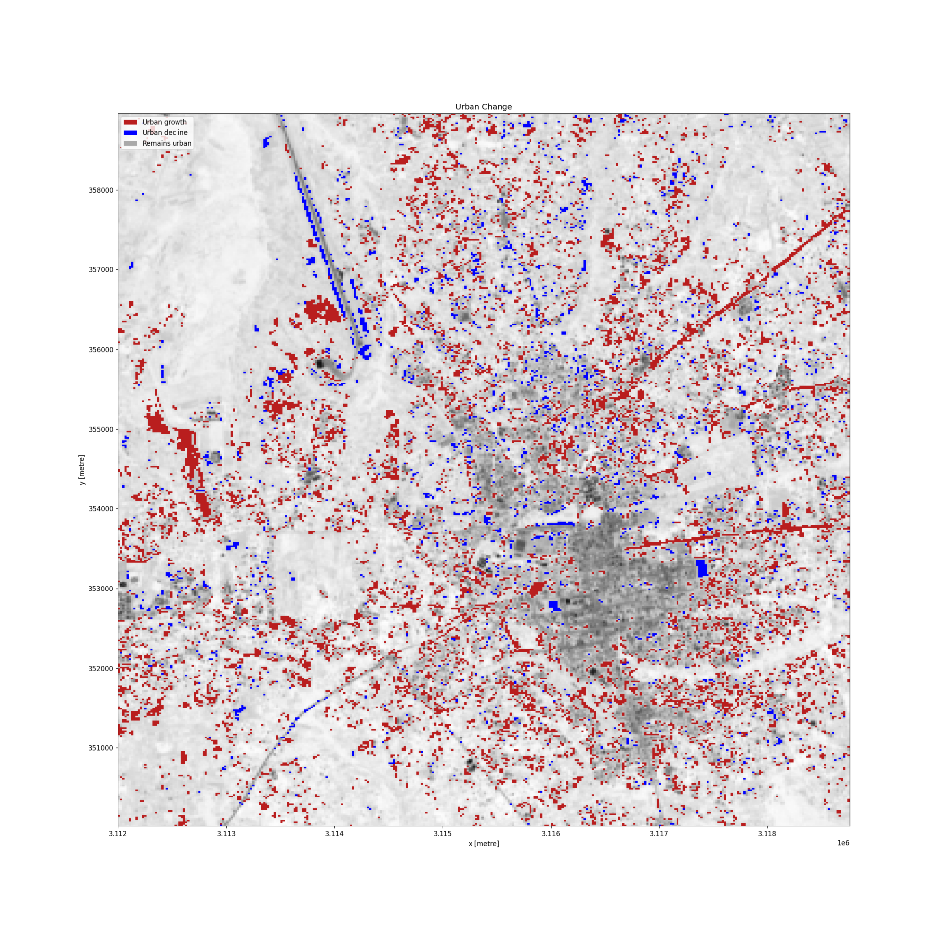
Across Africa, fields are turning into housing areas, settlements are expanding, and city borders are shifting. Often, this growth happens faster than our maps and planning systems can keep up with. As we mark World Cities Day on 31st October, it’s worth asking if decision-makers have the information they need to plan for this growth.
This year, the theme focuses on how renewing urban areas can improve access to housing and help build inclusive, climate-resilient neighbourhoods. Around the world, about 2.8 billion people face some form of housing problem, and nearly 1.1 billion live in slums or informal settlements. Africa’s move toward city living makes this challenge even more urgent. United Nations projections show that the continent’s population could grow from about 1.34 billion in 2020 to around 2.49 billion by 2050, with much of this growth happening in towns and medium-sized cities.
Discussions often focus on big cities like Johannesburg, Nairobi, and Cairo. However, smaller cities like Gulu, Kisumu, and Tamale will also play an important role in shaping the future of housing and city services. These growing cities need current, easy-to-access information to guide decisions on land use, infrastructure, and services.
Seeing where cities are growing
Planning for adequate housing starts with understanding where people are settling and how the city area is changing. Which neighbourhoods are growing fastest, where is green space shrinking as well as which settlements are in areas at risk of flooding. These answers can help planners understand needs and decide where action is most urgent.
Digital Earth Africa gives users access to satellite data that helps track changes in cities over time. By using satellite images from many years, users can see how cities have grown and use this information to make better decisions for sustainable city development.
For instance, in Gulu, northern Uganda, Digital Earth Africa data was used to compare the city’s size in 2017 and 2020. The mapped area grew from about 12.3 to 16.6 square kilometres, an increase of about 35 percent. The study also showed where most city growth happened. This information helps local authorities look beyond general population trends and see exactly where changes are happening. For city planners deciding where to put services like water, schools, or roads, knowing where and how cities are growing is a key first step. Similarly, Nairobi provides another example of how city growth affects quality of life. In a recent training with icipe researchers, the city was used to show urban expansion and to look at surface temperature trends. This raised a new question for city planning: how do changes in buildings and green spaces affect local heat levels.
Turning urban data into planning decisions
Mapping cities is more than just measuring how much a city has grown. Digital Earth Africa tools let users map built-up areas, check green space and tree cover, and calculate measures for sustainability reports. Combined with water and flood data, these tools help planners connect land use to people’s daily needs on which settlements face repeated flood risks, which areas need improvements the most and where could more green space make neighbourhoods more liveable.
However, satellite data can not answer every planning question, but it provides a solid evidence base for further study, community input, and policy decisions. Access to these tools is only part of the story, but people also need the skills to use them. Digital Earth Africa’s self-paced urbanisation course is made for those with no background in satellite data or coding. It helps planners, researchers, and others build practical skills to study city growth and use satellite data as evidence.
Better cities start with better evidence
World Cities Day encourages governments, professionals, and communities to consider how cities can be more inclusive, sustainable, and resilient. In Africa, achieving adequate housing will require data, funding, good planning, political will, and decisions that reflect local residents’ needs.
However, decision-making is harder when evidence is missing or old. Satellite data can help cities see how their urban areas are changing, spot new challenges, and ask clearer questions about where to invest and provide services.