 اللغة الإنجليزية
  البرتغالية
  الفرنسية
  العربية
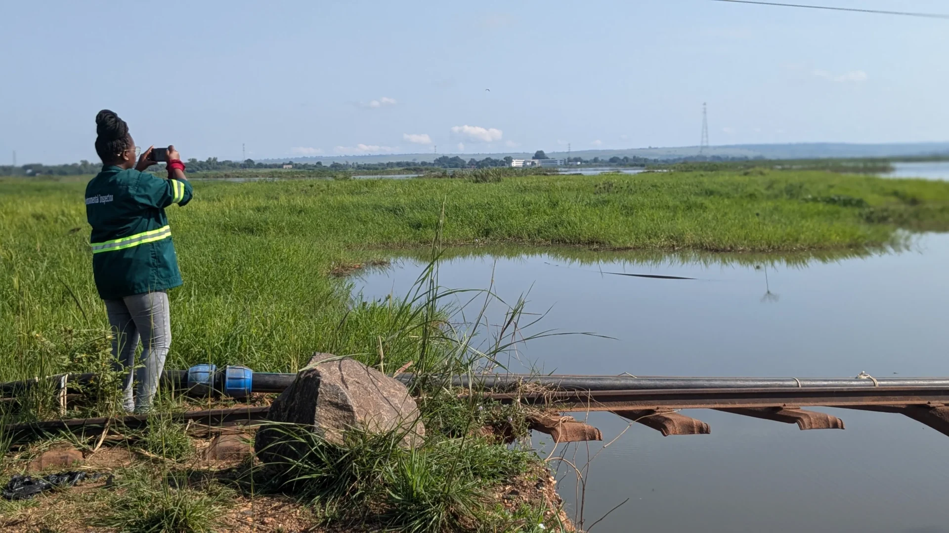
Wetlands are nature’s multitaskers. They host diverse wildlife, purify water, store carbon, regulate floods, and sustain livelihoods. Yet, in many parts of East Africa, these critical ecosystems remain poorly mapped and monitored. Enter the Wetlands Monitoring Project in East and Southern Africa (WAMP-ESA), a collaboration between Digital Earth Africa (DE Africa), RCMRD, and Geoscience Australia, which set out to change that.
Running from June 2024 to November 2025, WAMP-ESA focused on Kenya and Uganda, testing new satellite-based wetlands mapping tools, collecting field data, and training stakeholders. At its core, the project leveraged the DE Africa Sandbox, offering tools like the Wetlands Insight Tool (WIT) and Water Observations from Space (WoFS) to track wetlands’ seasonal variations and monitor environmental pressures.
From the office to the field: The project’s team of remote sensing experts, GIS analysts, and environmental specialists traveled to Kenya and Uganda to validate the new wetlands maps. In Kenya’s Naivasha region, teams worked with NEMA Kenya to compare satellite data with ground observations. In Uganda, fieldwork in Kampala and Mbale helped refine the draft products and calibrate the classification tools. These missions weren’t just about maps, they were opportunities for local experts to engage with cutting-edge tools, ask questions, and provide feedback, ensuring the maps reflect on-the-ground realities.
Capacity building was central to the project. Workshops in Naivasha and Kampala trained 22 stakeholders across government agencies, NGOs, and research institutions, including experts from the National Museums of Kenya, East African Wildlife Society, and National Forest Authority Uganda. DE Africa and RCMRD paid close attention to gender and diversity, ensuring a balanced mix of participants and supporting the next generation of Earth observation scientists.
The training translated into tangible outputs. Stakeholders developed use cases ranging from national wetlands monitoring frameworks in Uganda to local conservation projects at Yala Wetland in Kenya. These use cases demonstrated how the WAMP-ESA tools can guide decision-making, conservation planning, and sustainable management.
Beyond workshops, RCMRD and DE Africa promoted the project through blogs, social media, and webinars. Posts highlighted the tools’ accessibility, the insights they provide, and their real-world impact, making wetlands monitoring more visible to policymakers and the public alike.
WAMP-ESA wasn’t without its challenges. Limited training time and occasional toolkit errors required agile responses, but the project team navigated these hurdles, ensuring that participants left with practical skills and actionable data.
Looking forward, the WAMP-ESA project has laid a foundation for continuous wetlands monitoring across East Africa. By combining satellite data with local expertise, DE Africa and its partners have created a replicable model for sustainable environmental management, one that empowers stakeholders to track, protect, and restore wetlands for future generations.