 اللغة الإنجليزية
 البرتغالية
 الفرنسية
 العربية
Before a country can plan its next harvest, prepare for potential food shortages, or understand drought’s effects, it needs reliable information on where crops grow and how much land is farmed.
For Catherine Nakalembe, this challenge connects scientific research with the everyday realities of farming communities. Her early research on drought in Karamoja, Uganda, showed her the consequences of decision-makers lacking timely, reliable information when a growing season begins to fail.
Today, she leads NASA Harvest’s Africa programme and founded the Xylem Lab and Institute at the University of Maryland, supporting African researchers to lead scientific research and develop solutions grounded in their own contexts.
One question her research explores is: How can we measure how much land is used to grow crops?
Satellites can map farmland across large areas, and datasets provide information on where crops are grown. These maps are valuable, but they do not automatically provide an accurate estimate of the total area under cultivation. The challenge is knowing how closely a map reflects what is on the ground and how much uncertainty remains in the final estimate.
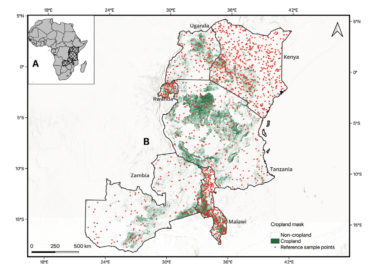
Catherine’s team, led by PhD student Adebowale Adebayo, examined seven freely available cropland maps across Kenya, Rwanda, Malawi, Tanzania, Uganda and Zambia. Using high-resolution imagery to check selected locations, the researchers assessed how well the maps represented cropland and how much additional verification would be needed to produce reliable estimates. The aim was to understand which maps could help countries estimate their farmland more efficiently while being transparent about the results’ reliability.
The right map depends on where you are
The research found that no single cropland map performed best in every country. However, Digital Earth Africa’s cropland product stood out across the six countries assessed: Kenya, Rwanda, Malawi, Tanzania, Uganda, and Zambia. It recorded the highest average producer accuracy for cropland at 0.73, meaning it was better at capturing cropland than missing it.
Digital Earth Africa’s cropland map ranked first in Rwanda, Malawi, and Zambia, and second in Kenya, Tanzania, and Uganda. Its performance reflects its dedicated focus on cropland at 10-metre resolution, rather than mapping cropland as one category among many in a broader land -cover map. Its training data also drew on the knowledge of people familiar with these agricultural landscapes.
The findings highlight that a map that performs well in one country may not be the best choice elsewhere. Different farming systems, landscapes and local conditions matter when selecting the most suitable product for estimating cropland.
Better information, less fieldwork
Comparing a map with locations where researchers can verify cropland helps them estimate how much land is farmed while accounting for uncertainty. Choosing an appropriate map can also reduce the number of locations that need to be checked.
In Kenya, the study found that one mapping approach required 616 reference points to reach the target precision, compared with 919 for the least efficient approach. That is 303 fewer locations requiring verification. Across the six countries, the number of reference points needed fell by 12% to 41%.
For agricultural agencies and research teams, fewer verification points can mean less fieldwork, lower survey costs and a more efficient use of limited resources. Catherine also points to the potential for countries to begin with a relatively small pilot exercise, using 50 to 100 reference points to compare mapping options before investing in a larger assessment.
The broader lesson is that reliable agricultural information doesn’t depend on a map alone. It also depends on knowing how to assess that map and design an efficient process for producing trustworthy estimates.
Zambia’s farmland
The importance of reliable estimates becomes especially clear when the numbers differ substantially. For Zambia, the research estimated approximately 6.3 million hectares of cropland, considerably more than the official figures cited in the study, which range from 1.4 million to 3.8 million hectares. The difference raises the question of which estimate more closely reflects the actual area under cultivation.
According to Catherine, the official figures lack documented uncertainty estimates, so they cannot be directly compared with the research findings. The study therefore highlights an evidence gap rather than establishing which figure is definitively correct. Reliable farmland estimates can support agricultural planning and help decision-makers better understand the scale and distribution of crop production.
Catherine sees an opportunity for Digital Earth Africa to contribute further by supporting an openly accessible, continually updated collection of validated cropland reference-point information that researchers and institutions can use, share, and build on, rather than repeatedly collecting the same data for individual projects. Such a resource could help make future assessments more efficient and strengthen the evidence available for agricultural decision-making.
Building African research with open data and local knowledge
Beyond the immediate findings, Catherine’s message to emerging African researchers is about making the most of the resources already available. Freely accessible satellite data and open tools provide opportunities to investigate questions that matter to African countries and communities. But access to data is only the beginning. Researchers also need strong analytical foundations, a clear understanding of uncertainty, and knowledge of the places they study.
Local knowledge is especially important for understanding how farming operates in a specific landscape and can help researchers interpret satellite observations and produce more meaningful results. The research offers a practical reminder that better agricultural information means making maps useful, understanding their limitations, and ensuring the evidence supports real decisions.
As African countries strengthen agricultural planning and food security, combining satellite observations with rigorous assessment and local expertise can build a more reliable picture of the land on which food production depends.