 اللغة الإنجليزية
  البرتغالية
  الفرنسية
  العربية
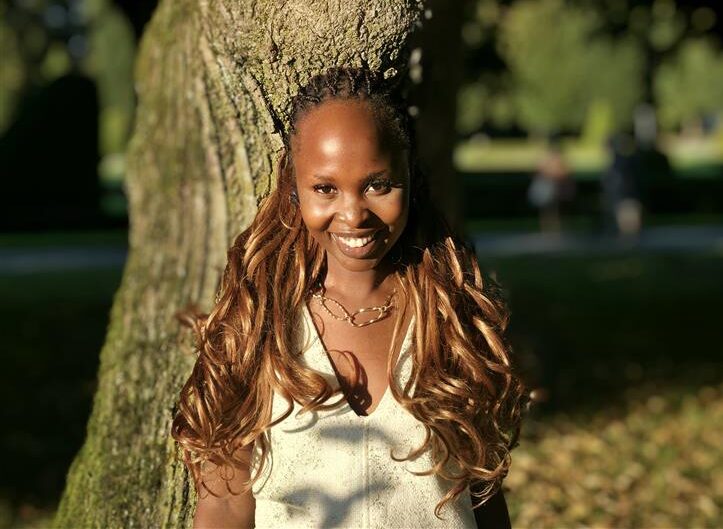
Leila Maritim is an Earth Observation Data Scientist at Digital Earth Africa, bringing a rich background in geomatics engineering, geo data science, and machine learning. A recent graduate of the Copernicus Master in Digital Earth (CDE) program, Leila specialized in cloud computing, big data analytics, and feature extraction using Graph Neural Networks. She first encountered DE Africa during a lecture in Europe and now applies the platform’s notebooks to streamline machine learning experiments and develop scalable EO workflows. As one of several Kenyan women to receive the CDE scholarship, Leila is passionate about increasing representation, fostering innovation, and enabling access to high-quality EO data for research and decision-making across Africa. Her journey reflects the bridge between global training and local impact, and in the following Q&A, Leila shares more about her experiences, insights, and vision for Earth Observation in Africa.
وصفي لخلفيتي الأكاديمية وتركيزي البحثي باختصار.
My academic journey started with a degree in Geomatics Engineering, where I acquired a broad foundation in Land and Engineering Surveying, Remote Sensing, Geographic Information Systems (GIS), Geophysics, and related disciplines. I subsequently pursued a specialization in Geo Data Science at the master’s level, which advanced my expertise in machine learning, computer vision, and big data analytics within the Earth Observation (EO) domain. My research focused on enhancing the performance of semantic segmentation through an object-based approach, emphasizing the integration of Graph Neural Networks (GNNs) for feature extraction. This work aimed to achieve more accurate and robust downstream semantic segmentation outcomes.
How did you first hear about Digital Earth Africa, and what drew you to its platform and tools?
I first learned about Digital Earth Africa (DE Africa) during a lecture at the University of Salzburg. It was quite remarkable that I had to move across continents to discover a platform dedicated to advancing spatial data access and analysis for the African continent. Earth Observation (EO) data plays a central role in my work; indeed, my entire career has been grounded in EO applications. I have applied EO techniques across various domains, including public safety—particularly in natural hazard assessment—and environmental monitoring, such as predicting the presence of kelp forests, among others.
What are you currently working on at DE Africa, and how does Earth Observation data support your work?
As an Earth Observation Data Scientist at Digital Earth Africa (DE Africa), I am engaged in prototyping and developing continental-scale water quality data products and upscaling on cloud infrastructures such as AWS. My work focuses on designing cost-effective DevOps processes to support the regular and automated production of satellite-derived water quality products. I am particularly excited to leverage my expertise in cloud computing and machine learning to build and maintain operational data pipelines, and to develop methods for accessing and analyzing these data products in conjunction with other DE Africa datasets and external data sources, thereby contributing to Africa’s data-driven growth.
Which DE Africa tools or datasets have been most useful in your projects, and why?
The DE Africa Sandbox has been instrumental in my prototyping work, providing ample storage and computational resources to conduct experiments effectively. It offers access to all the tools and datasets I need, allowing me to focus on developing and refining workflows without infrastructure constraints.
Can you share one achievement, insight, or project outcome that DE Africa enabled for you?
The current water quality project
Have you collaborated with others through DE Africa? How have these collaborations shaped your work or perspective?
My work is also highly collaborative, involving close coordination with both the science and platform teams. We share a common goal, and working together ensures a seamless integration of scientific innovation and technical implementation
What do you see as the biggest challenge for Earth Observation adoption in African research, and how could it be addressed?
For a long time, limited access to data was the greatest challenge to Earth Observation (EO) adoption in Africa. Fortunately, with the rise of open-source tools and platforms like Digital Earth Africa (DE Africa), this barrier is steadily being removed. The current priority is to raise awareness and ensure that scientists, students, and other stakeholders understand the capabilities and potential applications of these tools across various domains and disciplines, including non-traditional application areas.
What would you like to see DE Africa achieve next to support researchers across Africa?
I would love for data products developed by DE Africa to become the definitive standard for Earth Observation applications across the continent. That researchers can access consistent and ready-to-use products tailored for the African continent. I would love for all African governments to adopt these products for research, policy and commercial applications.
One piece of advice for young researchers interested in using DE Africa’s tools and datasets?
Curiosity and experimentation spark innovation, so explore the tools and build.