 Anglais
  Português
  Français
  العربية
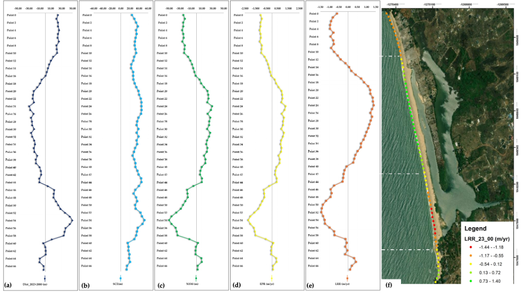
Over the past 23 years, millions of people living within a stone’s throw of the ocean have seen their beaches retreat, advance, and reshape under the combined forces of nature and human activity. Thanks to a new study presented at the 2025 IEEE MetroSea workshop, we now have a clearer picture of these dynamics, powered by Digital Earth Africa’s Coastlines product.
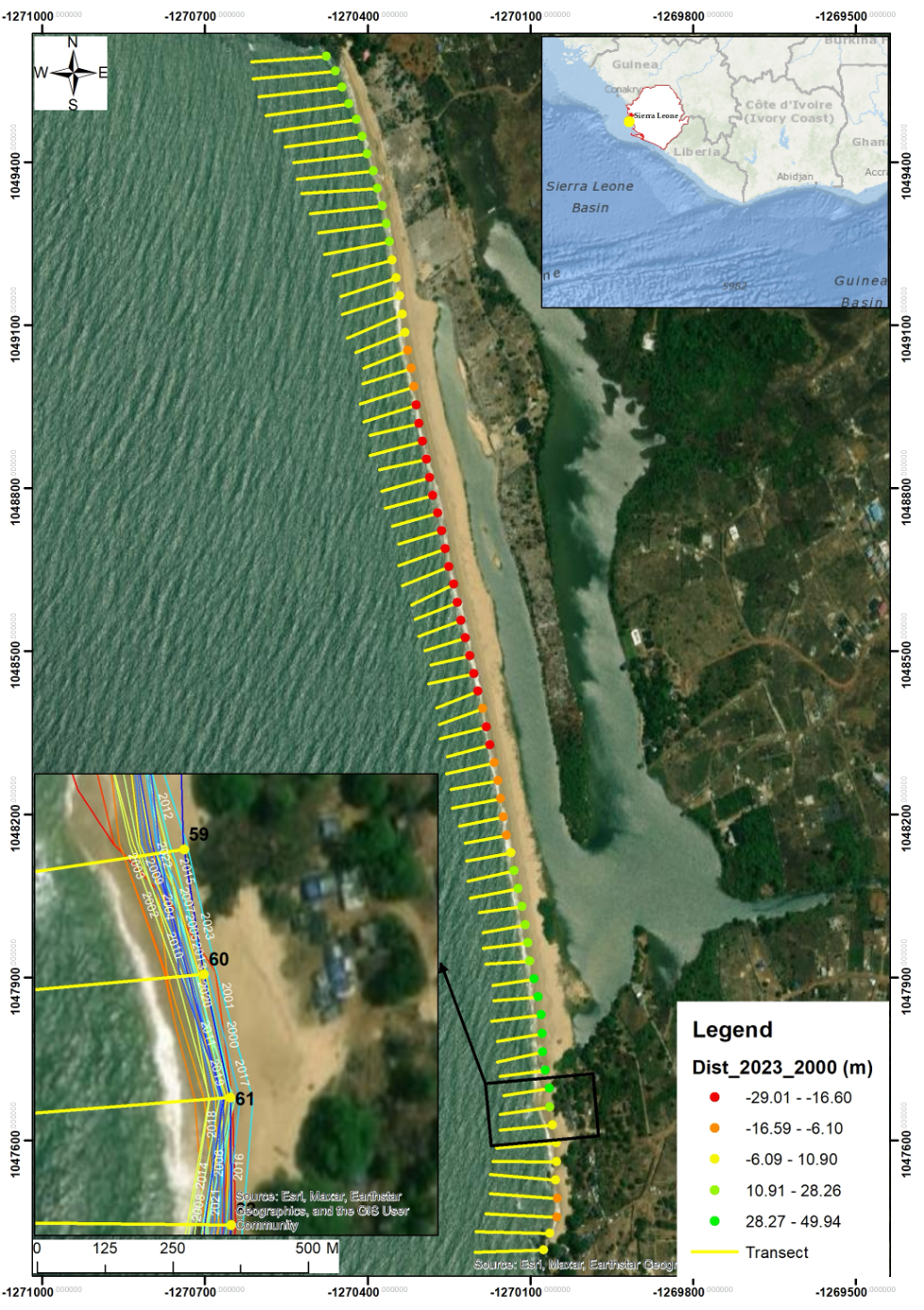
Led by Prof. Anselme Muzirafuti, a Rwandan geomatics and hydro-geophysics expert based in Italy, the study used DE Africa’s continental dataset spanning 2000–2023 to calculate a Long-Term Shoreline Trend indicator. This approach relies on open, satellite-derived data to track shoreline positions every 30 meters along Africa’s coast. By applying regression models, the team could identify areas where the shoreline is steadily retreating, advancing, or even recovering, turning decades of Earth observation into actionable insights for policy makers and coastal planners.
The findings are striking. Across Africa, approximately 7,582 km of coastline has retreated while 8,578 km has advanced. Around 709,775 people living within 1 km of low-lying shores are affected by these changes. Case studies from Morocco, Namibia, and Sierra Leone illustrate the diversity of coastal dynamics, with some beaches losing hundreds of meters of land while others expand. These insights are crucial: coastal regions are home to major urban centres, hubs of economic activity, and communities increasingly vulnerable to climate-driven hazards.

What makes DE Africa’s Coastlines product so powerful is its combination of accessibility, consistency, and detail. Unlike traditional coastal surveys, which are time-consuming, costly, and sometimes hazardous, DE Africa provides harmonised, annual shoreline data at continental, national, and local scales. For Prof. Muzirafuti, this meant being able to measure long-term trends with confidence, even in regions where conventional monitoring is scarce or non-existent. “These products allow us to see not just the past, but to predict future shoreline positions and their impacts on communities,” he says.
Looking ahead, the study highlights both the promise and the challenges of using satellite data to monitor Africa’s coasts. Spatial and temporal resolution limits, ground-truth gaps, and sensor biases still exist, but platforms like DE Africa are pushing the frontier. By integrating oceanographic data, tidal models, and even artificial intelligence, researchers can generate even finer-grained insights, empowering coastal communities to plan, protect, and adapt.
The data is out there, ready to be explored. DE Africa provides open, ready-analysed satellite products that are not just for scientists in distant labs but are tools for local impact, policy guidance, and sustainable coastal management. As Prof. Muzirafuti puts it, “These datasets are a treasure trove of knowledge that are waiting to be unlocked. Africa’s coasts deserve our attention, and satellites are enormously helping us for a valorisation of these ecosystems.”