 Anglais
  Português
  Français
  العربية
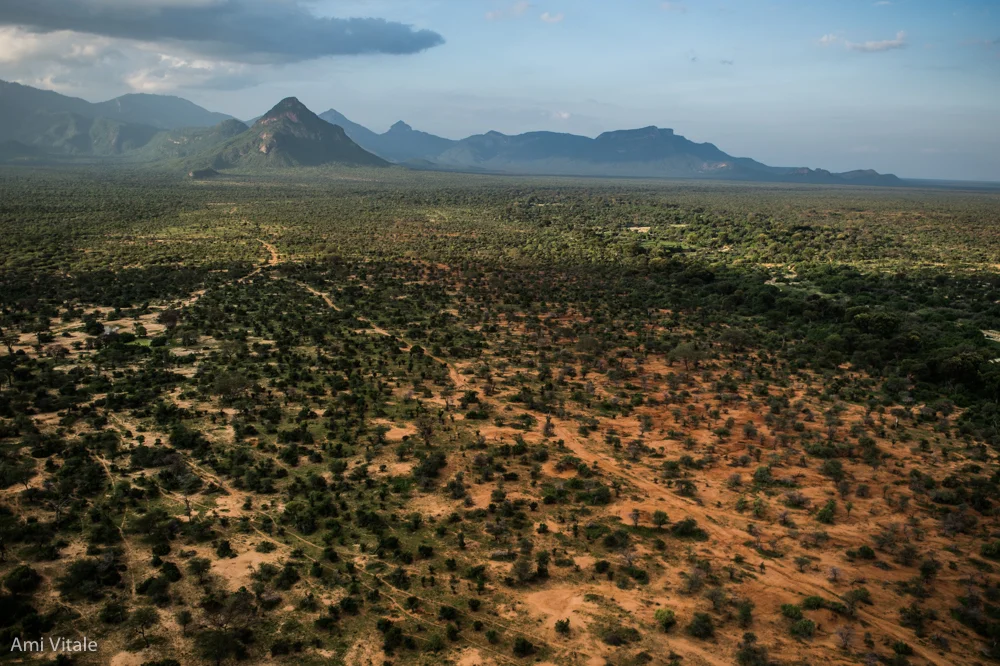
The rangelands of northern Kenya are vast, stretching across 80% of the country and sustaining millions of lives. They account for 90% of all employment opportunities and provide 95% of household income, mainly through livestock and pastoral livelihoods. Yet, in recent decades, climate variability, invasive species, and unsustainable grazing patterns have reduced their productivity, putting both people and wildlife at risk.
For over a decade, the Northern Rangelands Trust (NRT) has partnered with community conservancies in northern and coastal Kenya, as well as parts of Uganda, to restore these critical landscapes. Through rotational grazing, reseeding, gully healing, and the control of invasive woody species, conservancies are bringing back native grasses and reversing degradation. To date, more than 2 million hectares of land in northern Kenya are under improved grazing management. Now, a collaboration with Digital Earth Africa (DE Africa) is helping communities measure the impact of these efforts with satellite data, ensuring that successes can be tracked, communicated, and scaled.
The NRT Rangelands Programme empowers communities through conservancies to strengthen grazing plan implementations, manage rangelands at both conservancy and landscape levels, and increase awareness through community outreach. By combining traditional practices with new insights, communities are reviving their lands while strengthening resilience to climate change.
The current use case focuses on comparing vegetation health across twenty-two conservancies against baseline conditions, tracking trends in vegetation greenness and ground cover from 2013–2024 and identifying areas of improvement, as well as hotspots where degradation persists. This monitoring is vital for water and pasture management, livestock movement, conflict prevention, and conservation measures.
DE Africa provides access to free, decision-ready Earth observation datasets such as landsat and sentinel surface reflectance imagery, monthly NDVI (Normalized Difference Vegetation Index) values and fractional cover data that shows the proportion of green vegetation, dry vegetation, and bare soil. By using DE Africa’s tools, NRT can analyse seasonal cycles of vegetation productivity thus pinpointing the peaks and troughs of greenness each year and observing how these patterns have shifted over the last decade. This approach helps identify where re-greening is taking hold, where bare ground is shrinking, and where further action is needed. Importantly, it also provides a way to validate and communicate community-led successes in restoring rangelands.
Preliminary insights suggest that planned grazing management is driving measurable improvements in vegetation cover, even in the face of rainfall variability and other challenges. Communities are witnessing the return of native grasses to once-barren lands, a tangible proof that sustainable practices can halt and reverse degradation. NRT’s collaboration with DE Africa ensures that these changes are not only visible on the ground but also captured in datasets, giving conservancies the evidence needed to secure trust, expand investment, and continue scaling restoration efforts.
This use case represents more than a technical exercise. It is a story of community ownership, resilience, and innovation. By blending Indigenous knowledge with cutting-edge Earth observation, northern Kenya’s conservancies are charting a new path for rangeland restoration in Africa. As the programme continues, lessons learned will inform the next decade of work, ensuring that community-led initiatives remain central, while satellite data provides the evidence to track and share progress.
Together, NRT and DE Africa are demonstrating how technology can empower people on the ground to protect their livelihoods, restore ecosystems, and secure a sustainable future for generations to come.
For more on DE Africa’s collaboration with NRT on this use case, see the links below.
https://wildlabs.net/article/democratising-access-earth-observation-data-saving-wildlife-across-eas…