 English
  Português
  Français
  العربية
 Digital Earth Africa
Water Resources & Flood Risks
The Challenge
Managing Water Resources and Flood Risks
At the continental scale, Africa’s water resources are abundant, but issues including resource accessibility and variability contribute to large-scale water insecurity, impacting 1 in 3 Africans (400 million people) and severely hindering development progress.
Many African countries face significant water security challenges, with a combination of natural and human factors including climate change and unsustainable practices negatively impacting water availability and quality.
Decision makers have to contend with the active management of existing water resources to address rising demand and increasing scarcity, while also mitigating risks around seasonal flooding and extreme climate events that affect millions across the continent each year.
With numerous transboundary river basins, managing Africa’s water resources is a complex undertaking, and inadequate data on water availability, use and quality hinders effective decision-making.
The Solution
Enabling Powerful Water Bodies Analysis
Surface Water Availability
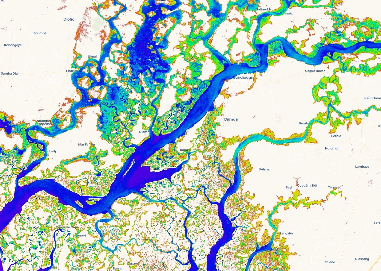
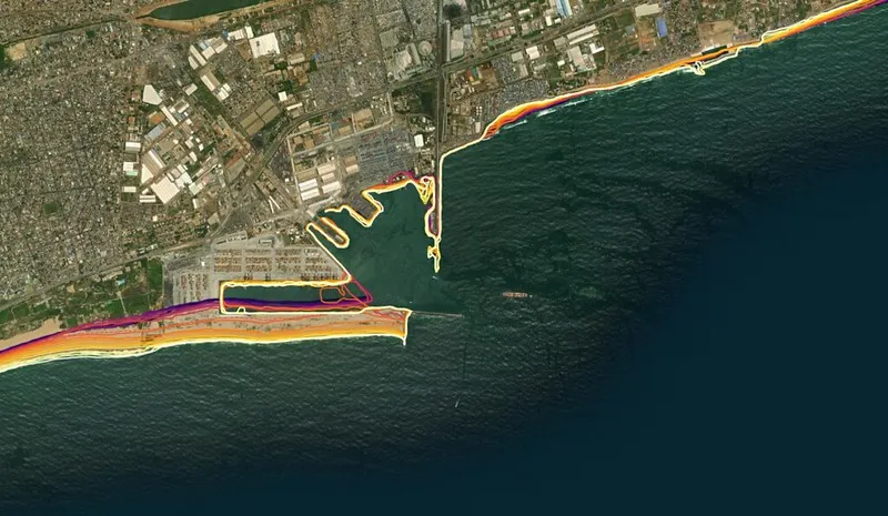
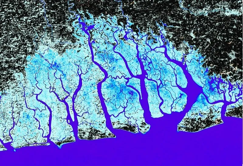
Digital Earth Africa’s Water Observations from Space translates over 30 years of satellite imagery into easy to consume information on the presence, location and recurrence of water across the continent. This allows users to visualise, map and assess surface water resources effectively and efficiently, enabling data informed decision making. Sufficiently detailed for local to national scale analysis, the service offers a comprehensive overview of surface water dynamics including flood frequency and risk based on past occurrence.
Monitoring Water Bodies
Digital Earth Africa’s Waterbodies Monitoring service maps over 700,000 persistent and seasonal water bodies across the continent, documenting the change in their water surface area over time. The Waterbodies Monitoring Service has been developed to address gaps in existing waterbodies datasets and ensures increased interoperability and accessibility for users, and can be used for monitoring water bodies such as wetlands, lakes and dams in remote and/or inaccessible locations.
Assessing Water Quality
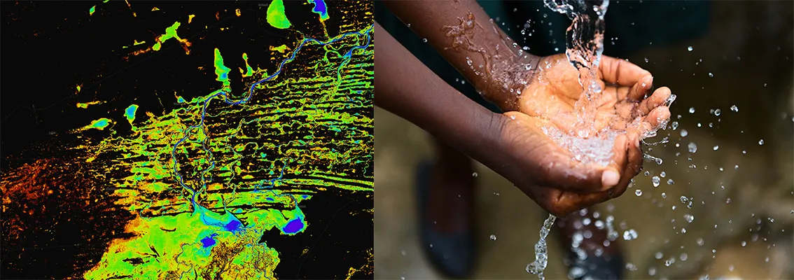
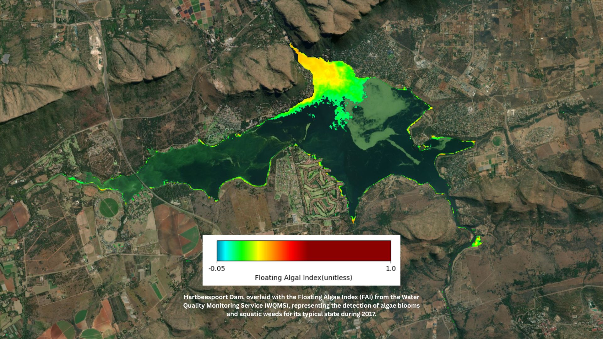
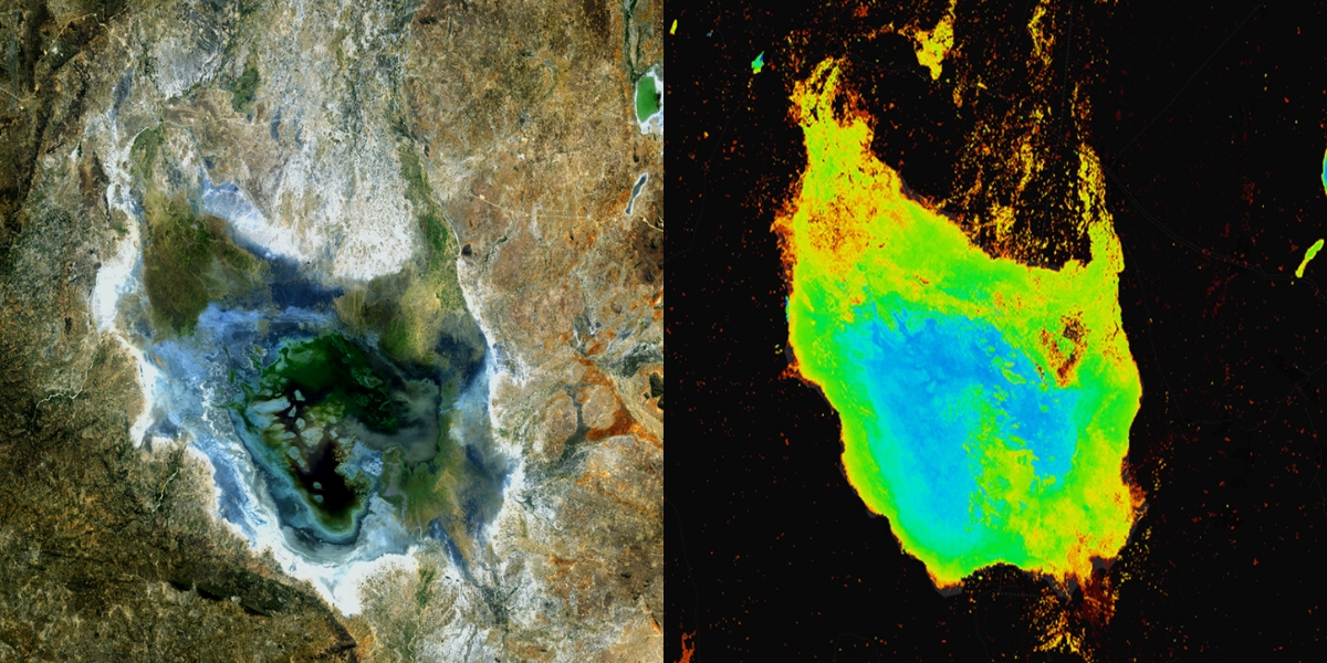
A collection of tools are available to users to monitor water quality through a series of different indicators. These support the assessment of properties such as the overall turbidity of the water, the presence of algal blooms, the colour and temperature of the water, and the levels of Chlorophyl-A, and how they are changing over time.
Digital Earth Africa
A Path Forward: Improving Water Management
Digital Earth Africa provides a suite of water monitoring and evaluation tools that offer a new way for decision makers to address issues of water accessibility and variability across the continent.
Suitable for local to continental scale applications, these enable stakeholders involved in the management of water resources, urban planning and wetland conservation to better understand surface water availability, quality, and changes over the past three decades.
The Impact
Effective water management
March 26, 2026
Digital Earth Africa launches continental Water Quality Monitoring Service to strengthen evidence-based water management

March 5, 2026
Championing the next generation of African geospatial talent: A conversation with Nancy Wayua
Related Topics
Coastlines
Our Coastlines Monitoring Service leverages satellite data to map the historical position of the African coastline over time. It provides insights into past changes and highlights areas of potential concern for the future.
Water Observations from Space (WOfS)
Water monitoring and management was identified as the first priority area for DE Africa. To address this, we have made a continental scale water monitoring service available.
Waterbodies Continental Service
The Waterbodies Monitoring Service identifies more than 700,000 unique water bodies across Africa, incorporating over forty years of satellite observations.