 English
  Português
  Français
  العربية
 Digital Earth Africa
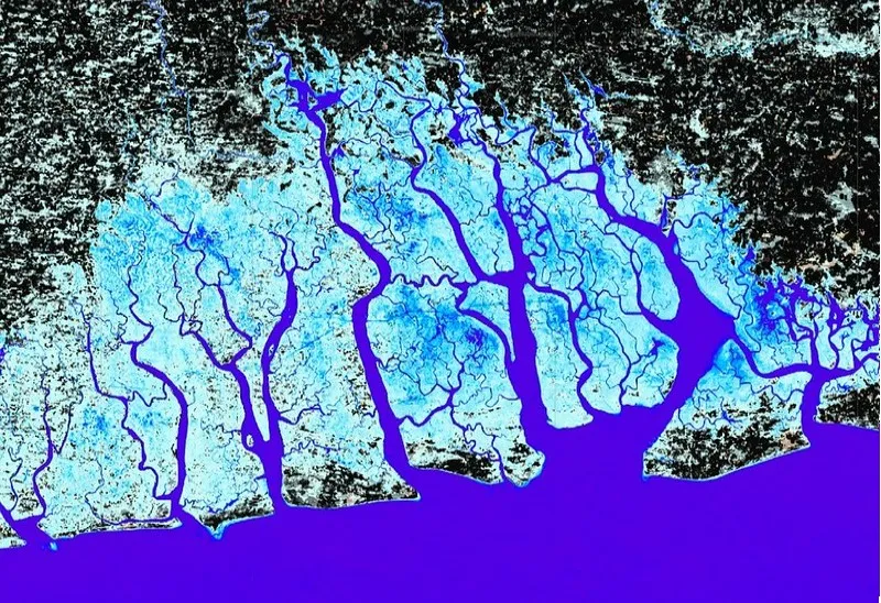
Water Observations from Space (WOfS)
Powerful Observations Identify Africa’s Changing Water Resources
Water Observations from Space (WOfS) is a Digital Earth Africa Continental Service that translates years of satellite imagery into easy to consume information on the presence, absence, and recurrence of water across Africa. This allows users to map, assess, visualise, and manage water resources and understand trends over time.
Based on forty years of satellite data, the Service provides a historical record of surface water extent across the entire African continent. WOfS enables users to understand the location and movement of inland and coastal water over time, showing where water is usually present; where it is seldom observed; and where occasional inundation of the surface has been observed helping in particular to identify and map floodplains.
Key Features
Water Observations from Space (WOfS) empowers Africa with satellite-based insights for sustainable water management. It helps track water trends, supports informed decisions, and addresses challenges like floods and droughts.
WOfS Feature Layer (WOFL)
Individual water-classified images are called Water Observation Feature Layers (WOFLs), and are created from the input satellite data. There is one WOFL for each satellite image processed showing the occurrence of water. New scene-level data are added as soon as a new satellite image is available.
WOfS Annual Summary
Allowing users to see how surface water extent has changed over the course of a year, the annual summaries provide statistics of the percentage of times each pixel was classified as water (wet) during each calendar year, relative to the total number of clear observations in that year.
WOfS All-Time Summary
Provides a long-term perspective on the presence of surface water, helping to identify trends and patterns. This product calculates the percentage of times a pixel was classified as water across all Landsat observations, from 1984 to the present.
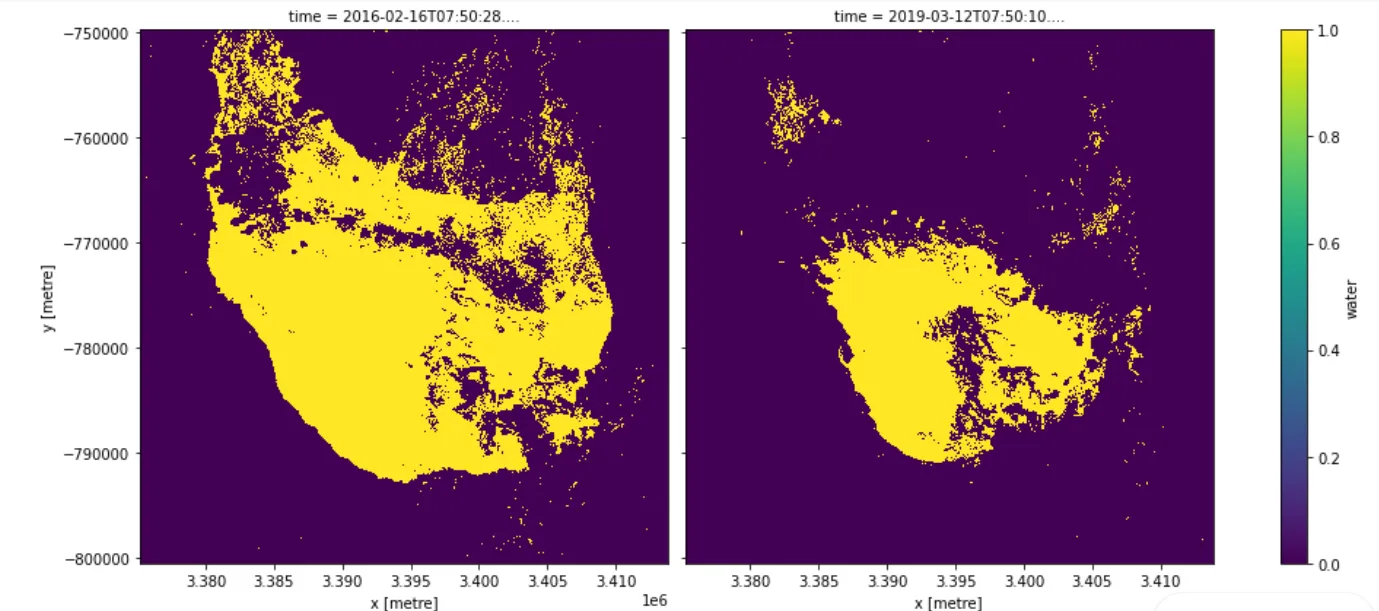
Mapping longer-term changes in water extent with WOfS
The water extent notebook is an analysis tool that enables users to create their own customised WOfS products, tailored to their specific needs. The example below shows how this tool has been used to highlight changes in the extent of water-related ecosystems over time around Lake Sulunga, in Central Tanzania.
Applications
Monitoring Water Availability
The service provides insights into surface water availability during dry seasons, enabling proactive planning for water resource management and ensuring access to essential water supplies.
Understanding Environmental Change
Through historical and near real-time data, the service identifies trends in the size and surface extent of waterbodies, helping users understand long-term environmental changes as well as the impact of shorter climatic events such as droughts.
Assessing Flood Risks
By analysing variations in water surface areas, the service aids in predicting potential flood risks, improving disaster preparedness and mitigation strategies for vulnerable communities.
Related Use Cases
March 26, 2026
Digital Earth Africa launches continental Water Quality Monitoring Service to strengthen evidence-based water management

March 5, 2026
Championing the next generation of African geospatial talent: A conversation with Nancy Wayua