 English
  Português
  Français
  العربية
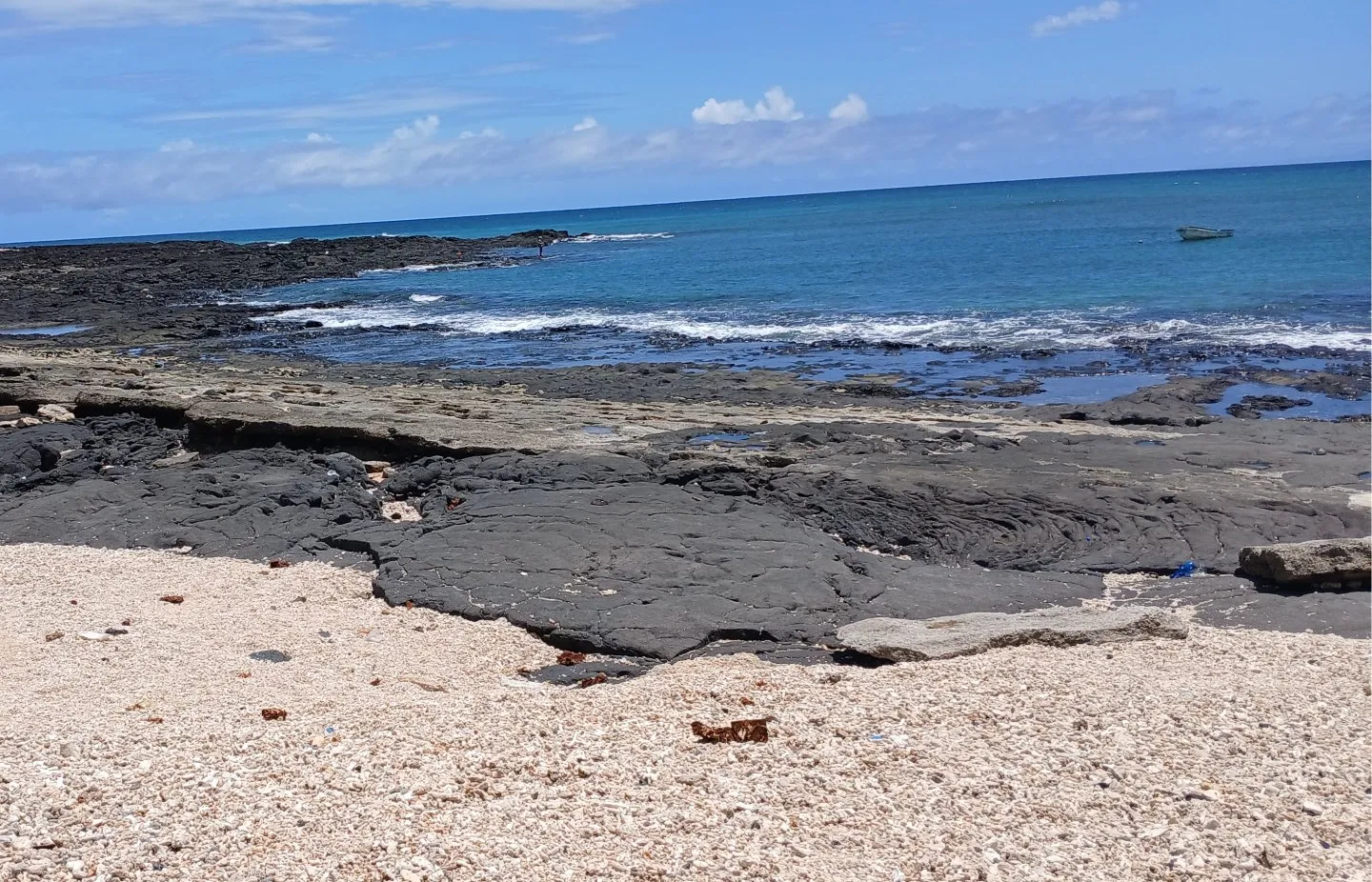
The breathtaking coastlines of Comoros are not just picturesque; they’re the lifeblood of the nation. With an exclusive economic zone (EEZ) 85 times larger than its land area, the ocean is central to the country’s identity. With around 41% of the country’s population living around or along the coastline, approximately 140,000 people, or about 16% of the population, rely on fishing for their livelihoods, contributing 10% to the national GDP. However, these vital coastal regions face mounting threats from environmental challenges like coastal erosion, flooding, droughts, and rising sea levels.
The government of Comoros is committed to acting in response to these issues by improving water governance and infrastructure.
Recently the Regional Centre for Mapping of Resources for Development (RCMRD) with support from Digital Earth Africa, spearheaded a data collection and data validation mission to monitor the extent and impacts of coastal erosion.
Working in consultation with Comoros’ Cartographic Unit and the Bureau Géologique des Comoros, the mission drew upon a multi-disciplinary team of experts with the aim of demonstrating how cutting-edge geospatial technology could support data-based management of Comoros’ vulnerable shorelines.
Addressing a growing concern
Coastal erosion is an urgent environmental challenge, with rising sea levels and human activity contributing to its acceleration. The mission aimed to validate recently developed modules for coastal erosion mapping while strengthening stakeholder collaboration on the ground.
Comoros was selected for this initiative based on a thorough needs assessment and the country’s interest in coastal erosion monitoring. The Ministry of Territorial Boundaries and Urban Planning in Comoros had shown significant engagement with the issue, particularly as coastal erosion continues to undermine local infrastructure.
A collaborative approach to data collection
From November 25 to December 3, 2024, a dedicated team, comprising GIS experts, data analysts, and local cartographers, embarked on a mission to collect critical baseline data. The team worked closely with Comoros’ Cartographic Unit and the Bureau Géologique des Comores, ensuring local engagement and knowledge-sharing.
Leveraging the DE Africa Sandbox, a cloud-based platform, experts developed draft coastal erosion monitoring maps. The field team used Kobo Toolbox, a mobile data capture tool, to document essential information, including GPS coordinates, erosion rates, and probable causes of coastal changes.
Key findings from the mission include the identification of 89 coastal erosion hotspots, with 60 located in Grande Comore and 19 in Moheli. Coastal hotspots are areas where several coastal issues converge, often due to a combination of natural hazards and human vulnerability, thus creating areas of risk. These hotspots were found to have direct social and economic consequences for local communities, affecting schools, businesses, roads, and agricultural lands.
The sheer volume of hotspots underscores the urgent need for intervention in the most affected regions.
Challenges and opportunities
The mission was not without challenges. The rugged terrain and limited accessibility to some coastal sites, coupled with language barriers and extreme heat, posed obstacles to field data collection. However, these hurdles highlight opportunities for enhanced local engagement and cooperation.
Additionally, collaboration with institutions such as Moheli National Park and the Geological Bureau of Comoros presents a promising avenue for long-term coastal conservation efforts. Recommendations from the field mission stress the importance of capacity building, policy engagement, and integrating geospatial data into national environmental strategies. A holistic training approach that includes farmers, fishermen, infrastructure managers, and other stakeholders will be key in addressing these challenges.
Looking ahead: A call to action
The successful completion of this mission marks the beginning of a new chapter in coastal resilience for Comoros. As data-driven insights become available, decision-makers can implement targeted interventions, such as the integration of erosion monitoring into national planning frameworks and stricter controls on sand harvesting. Sand harvesting in the Comoros, due to the rise in small-scale and artisanal mining operations, has led to coastal erosion and degradation.
To strengthen future efforts, follow-up collaborations with local partners and institutions will be essential, particularly to enhance training and capacity-building initiatives. Additionally, incorporating key statistics about the economic dependence on fishing, livestock farming, and the percentage of arid land in the region will further emphasize the urgency of addressing coastal erosion.
Digital Earth Africa and RCMRD remain committed to working alongside Comoros’ institutions to ensure the sustainability of this initiative. By leveraging Earth observation data, the nation can safeguard its coastal heritage, protect vulnerable communities, and build resilience against the forces of nature.