 English
  Português
  Français
  العربية
Across nearly 32,000 hectares of Zambian landscape, the signs of recovery are showing up in the data. On most monitored sites, vegetation is trending upward against years of the site’s own history. From an office in Lusaka, a small team is tracking it using satellite data that, until recently, was effectively out of reach.
Rinato Space builds satellite land and crop monitoring tools for organisations that manage land at scale in Zambia, from restoration programmes such as World Vision’s to institutional partners in government and agriculture. Its platform, RX AI, pulls together satellite-derived signals to track what is happening on the ground and measure it rigorously against each site’s own history.
A credible landscape-recovery trend is built on years of data per site: a directional read needs a minimum of about three years, and the longer the history, the stronger the signal. Across 2,700 sites, that means millions of observations. Rinato Space’s previous data supplier became a bottleneck almost immediately. Each site, each year, each index required a separate API request. In a country where internet infrastructure is inconsistent, the volume alone made the backfill impractical. Three months into a process that should have been routine, the team was still waiting.
Digital Earth Africa’s analysis-ready archive offered a different model entirely. Rather than querying a remote API request by request, Rinato Space could download bulk imagery for Zambia and process it locally which was a critical distinction for teams working with infrastructure constraints. Consistent calibration mattered just as much as access. The supplier’s data prior to 2017 was produced using a different processing method, making direct comparison with more recent imagery unreliable without significant adjustment work. DE Africa’s archive had already resolved that since the corrections were built in. “All you need is just to download it as is,” Ahmad Hamwi, Rinato Space’s co-founder, explains. “You don’t have to recalculate what you would usually have to do through the previous data supplier.”
What Rinato Space does with that data sets it apart from most monitoring platforms. Where others deliver a single index such as an NDVI reading, or a moisture value and leave interpretation to the client, RX AI combines up to 39 computed data layers, each calibrated to a specific crop at a specific stage of its growth cycle.
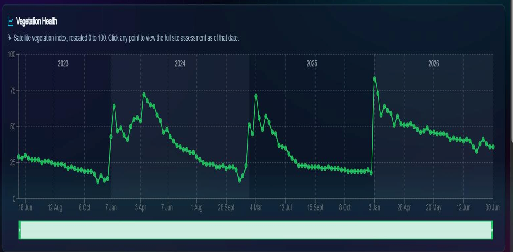
Credit: Rinato Space / RX AI.
The distinction matters in practice. For instance, a cotton plant in its first 20 days behaves very differently from one three weeks later. A standard platform might flag a shift from green to red as cause for alarm. RX AI knows that at certain growth stages, that shift is expected, meaning the plant is forming bolls. Without crop-specific calibration, the data misleads as often as it informs.
The same rigour shapes the restoration monitoring. Rinato’s method pairs each site with a nearby reference site left outside the restoration project and compares the two trajectories over time, screening for the confounding effect of regional rainfall so a real change can be told apart from a good or bad rain year. Across the assessed landscape sites, 94.5% are stable or improving. Rinato holds confidence at medium and treats field validation as the next step: the platform is built to flag when it does not yet know, rather than force a verdict, which is why partners trust the verdicts it does return.
Rinato Space was named one of two Small Business Champions selected worldwide in 2026 by the WTO and ITC, for applying AI to international trade, and presented on the AI for Good Frontier Stage in Geneva.
Sven, Rinato Space’s Co-Founder and COO, is direct about what the company is and is not. “We are a proper homegrown, African company. We have both worked in farming and agriculture. We have been on the ground and have seen all the issues.” That perspective is what shaped the decision to validate rigorously, calibrate carefully, and build for the realities of the regions the tool is meant to serve.
The algorithms Rinato Space has developed are not Zambia-specific. The company has a growing pipeline of multi-country work across the region, applying the same approach to new landscapes wherever the baseline conditions can be established.