 English
  Português
  Français
  العربية
 Digital Earth Africa
Land Degradation and Coastal Erosion
The Challenge
Protecting against land degradation and coastal erosion
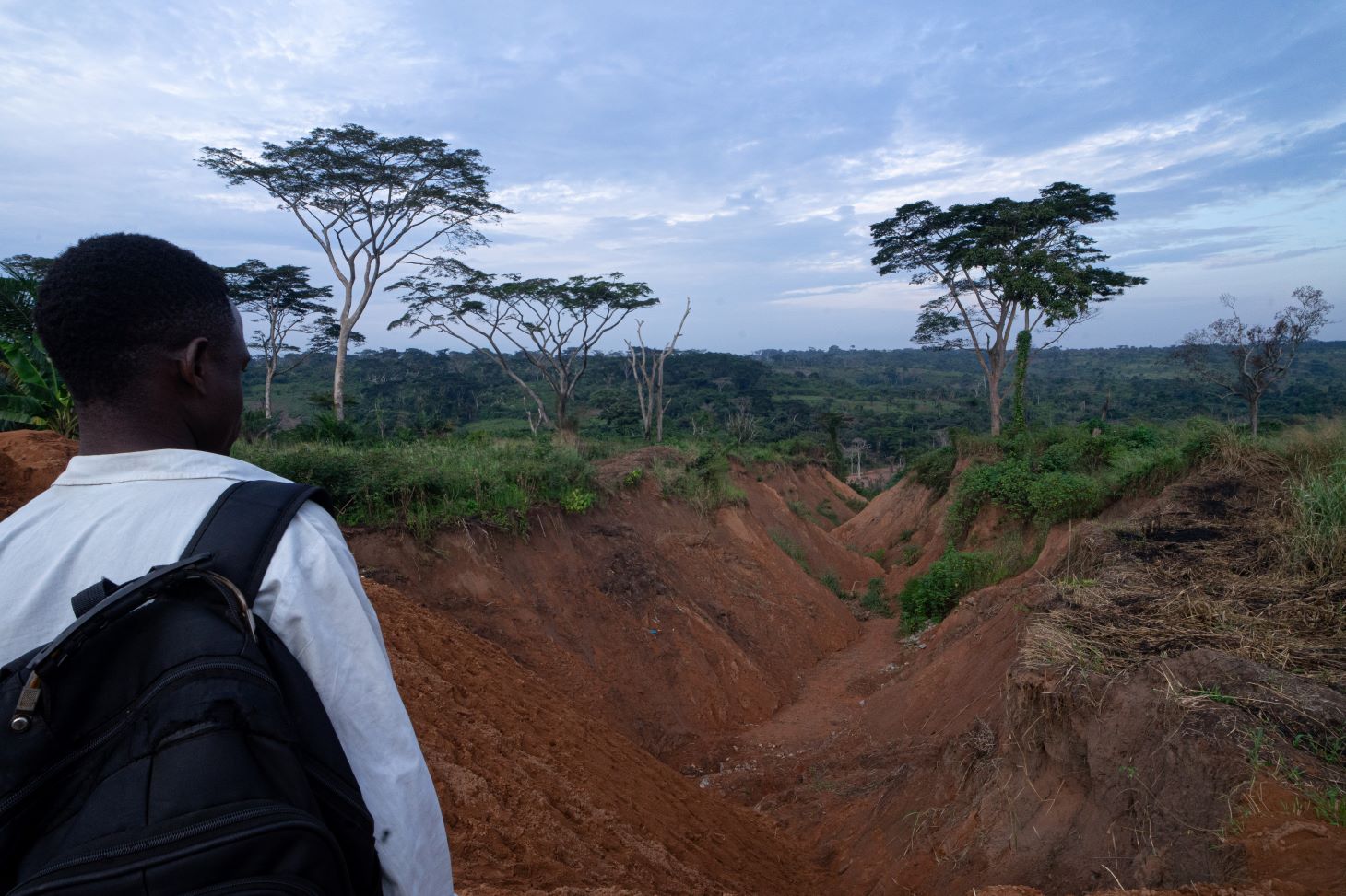
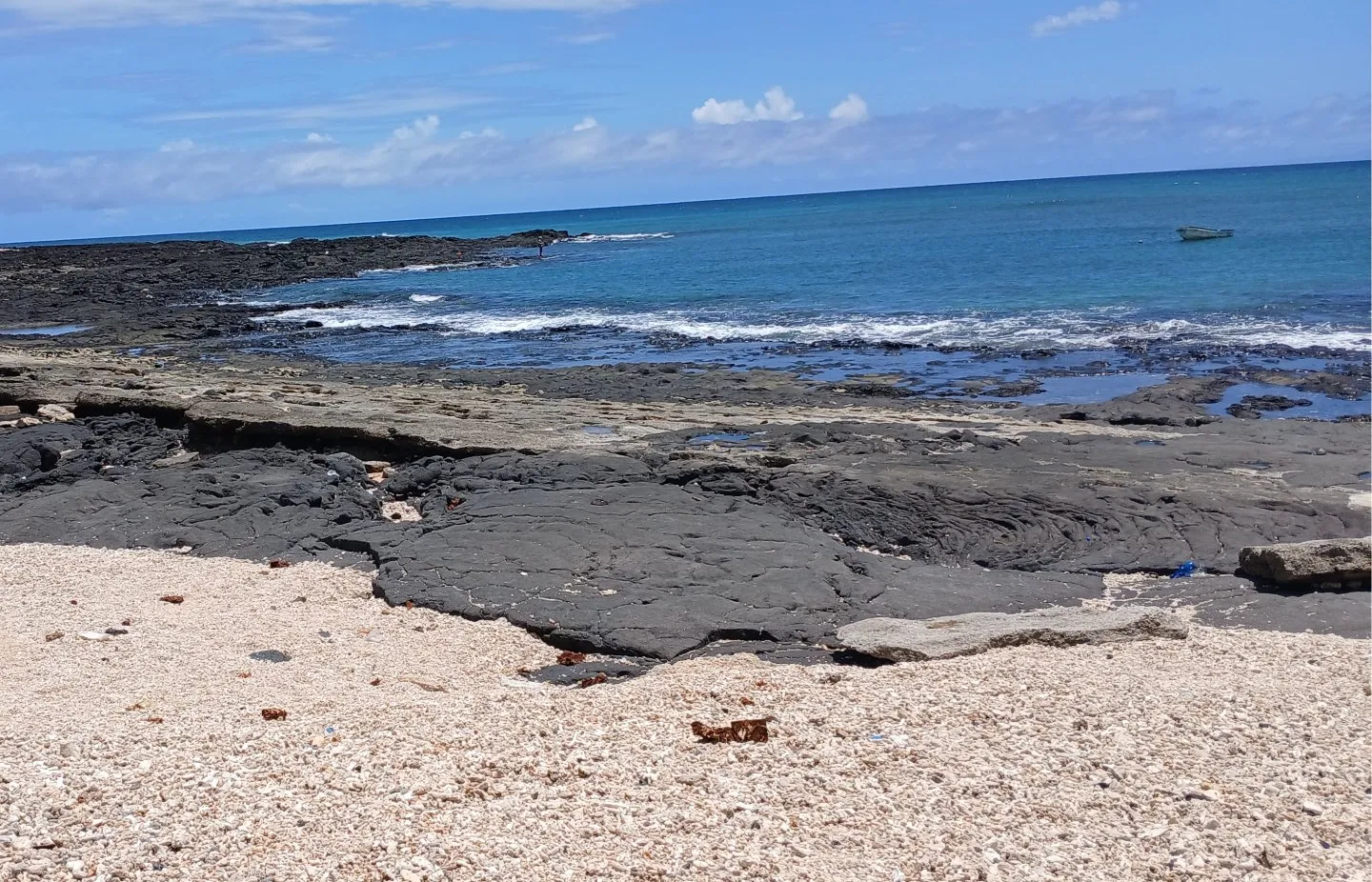
Land degradation and coastal erosion affect the lives of millions of people, causing significant economic, environmental, and social impact. It leads to loss of land, property, and infrastructure. Although erosion is a natural process, it is exacerbated by human activity, such as infrastructure construction and vegetation removal.
Coastal erosion has already caused major displacement in West Africa, where shoreline degradation has collectively cost local economies billions of dollars.
It is estimated that around 45 percent of Africa’s land is impacted by degradation, reducing agricultural productivity and increasing vulnerability to natural disasters.
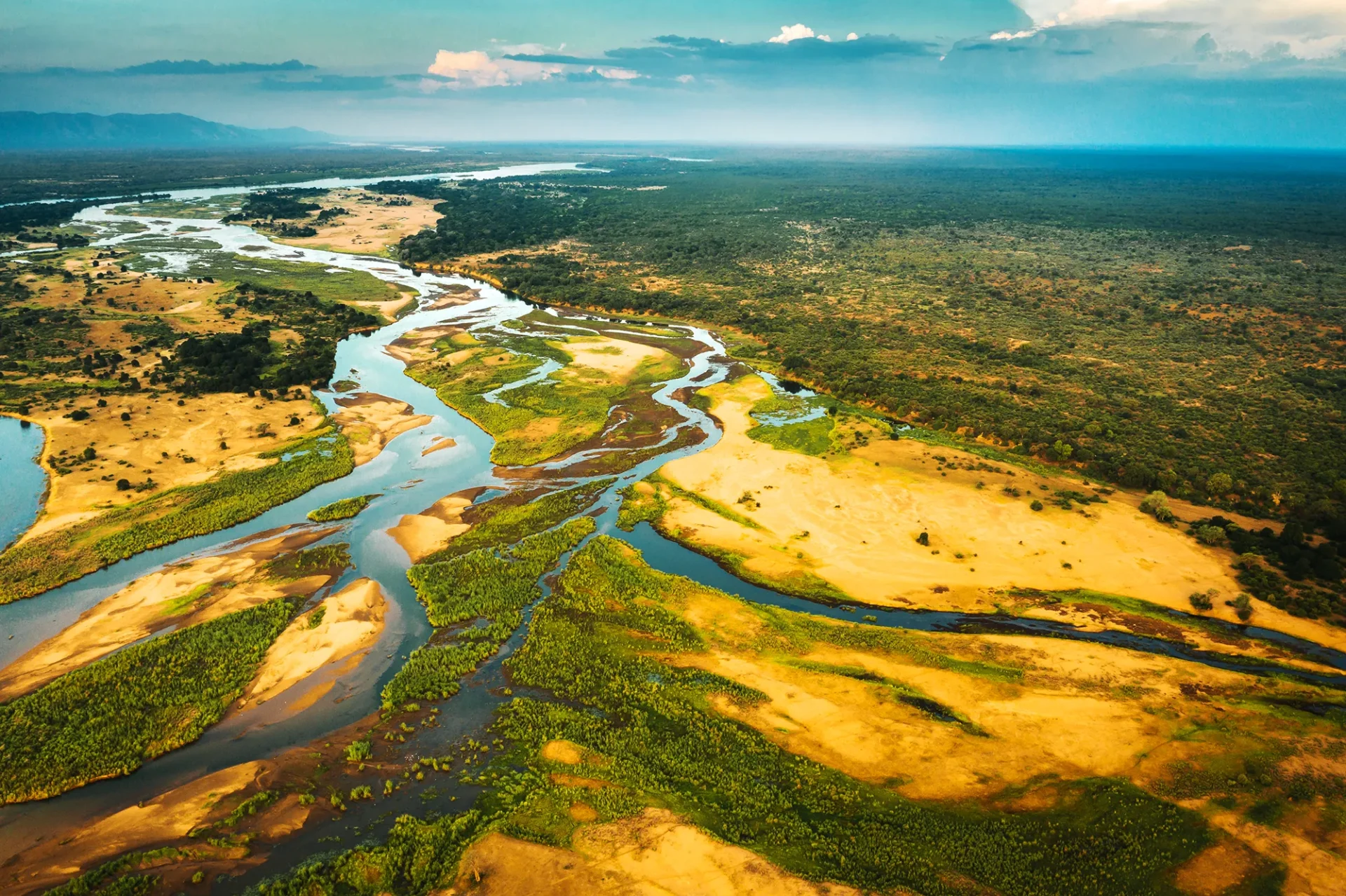
Probability of cropping in the Nile Delta, with yellow indicating crops, processed by Digital Earth Africa.
The Solution
Protecting Coasts, Communities and Environments
Digital Earth Africa provides two Continental Services designed to inform strategies to manage land degradation and coastal erosion.
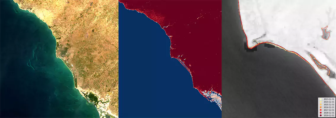
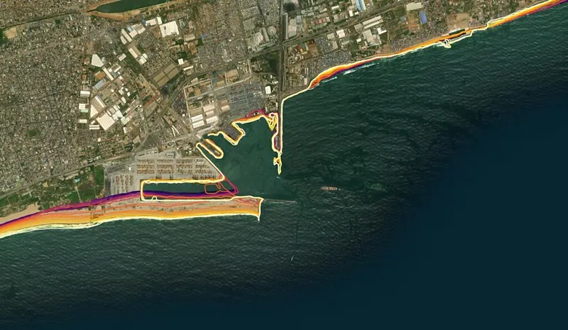
Effective management of coastal changes and mitigation of risk, as well as sustainable coastal zone management, rely on consistent and regularly updated data. Addressing this need, Digital Earth Africa’s Coastlines Monitoring Service provides comprehensive data to monitor, analyse, and understand changes along Africa’s coastline.
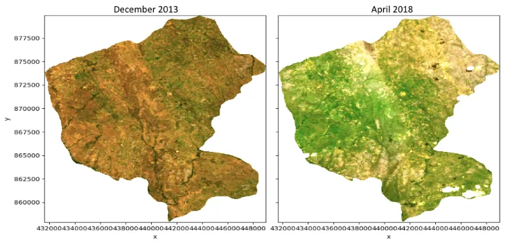
For land areas, Digital Earth Africa’s Fractional Cover Service splits landscape observation data into three parts enabling measurement of green vegetation, dry vegetation, and bare ground, providing insights into not only vegetation, soil and water, but also land, crop and grazing management. Available on an annual basis this continental service provides a long-term record for monitoring land cover changes and understanding environmental conditions.
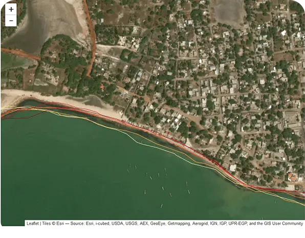
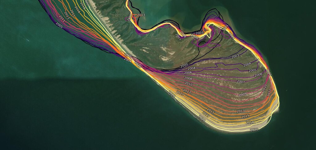
Historical & Current Coastline Mapping
Derived from analysis of satellite data from 2000 to the present and tidal modelling, annual maps enable users to pinpoint past and recent coastline locations, monitor the rate of change, and detect at-risk areas.
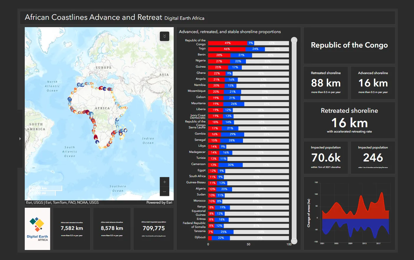
Continental & National Insights
Analyse coastal retreat and growth at both local and continental scales to understand the impact of natural and human-induced changes such as extreme weather events and human development, to inform effective coastal management strategies. A dedicated coastlines dashboard provides national scale summaries for each African country with a coastline, providing essential insights and informing national coastal adaptation needs.
Landscape Change
Annual maps from 1984 contribute to assessment of soil erosion, ecosystem and vegetation modelling. Understanding patterns in the condition and extent of vegetation within ecosystems can inform policy, decision making and land management practices.
Digital Earth Africa
Coasts – Economic Hubs in Africa
Coastal areas are critical for the development of a growing number of economic activities. Digital Earth Africa’s services have the potential to help policymakers identify coastal erosion hazards, saving African countries ~$600 million per year.
Related Topics
Coastlines
Our Coastlines Monitoring Service leverages satellite data to map the historical position of the African coastline over time. It provides insights into past changes and highlights areas of potential concern for the future.
Coastlines Dashboard
The Coastlines Monitoring Service dashboard offers an intuitive tool for mapping and monitoring the African coastline’s evolution over the last 24 years, providing comprehensive coverage of the entire coastline.
Waterbodies Continental Service
The Waterbodies Monitoring Service identifies more than 700,000 unique water bodies across Africa, incorporating over forty years of satellite observations.