English
  Português
  Français
  العربية
 Digital Earth Africa
GeoMAD
Precision Insights from Satellite Imagery for any Timeframe
GeoMAD offers more than high-quality image production – it’s an invaluable tool for analysing changes over specific time periods. For example, the semi-annual GeoMAD service can monitor seasonal variations in rainforest areas, tracking shifts in vegetation cover. A rolling GeoMAD analysis, updated monthly using a three-month rolling window, provides ongoing insights into evolving environments.
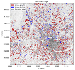
The composite nature of GeoMAD enables improved image summaries for regions with high rainfall, where daily satellite captures are often hindered by cloud cover. This makes GeoMAD particularly effective for studying the impacts of coastal erosion, flooding, and urbanisation.
The suite of GeoMAD services available are:
- Semi-annual GeoMAD (Sentinel-2)
- Annual GeoMAD (Sentinel-2 or Landsat 8)
- Rolling GeoMAD
How GeoMAD Works
GeoMAD combines surface reflectance values over a specified time period to create a representative value—known as the geomedian—for each pixel. This geomedian can be used to generate true-colour images that depict what’s on the ground with remarkable accuracy.
Using GeoMAD enhances cloud cover correction and reduces noise for multi-year comparisons. The inclusion of a semi-annual GeoMAD further improves visibility of seasonal changes, enabling detailed monitoring of rapidly evolving landscapes.
Birds-Eye View
Inspect continental Africa as it appears to the human eye by selecting Geomedian – Red, Green, Blue.
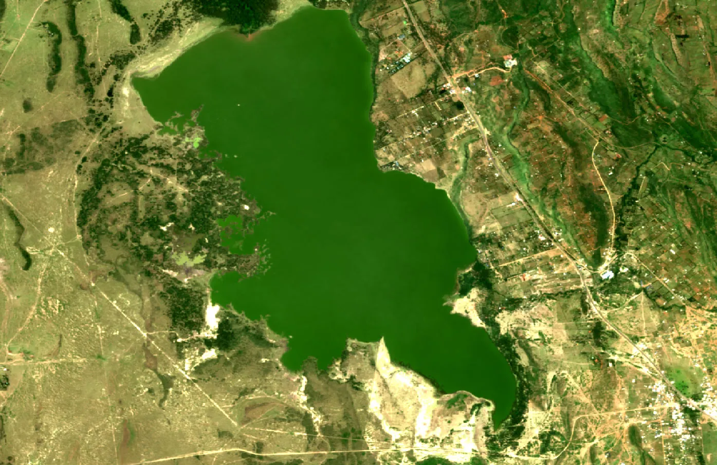
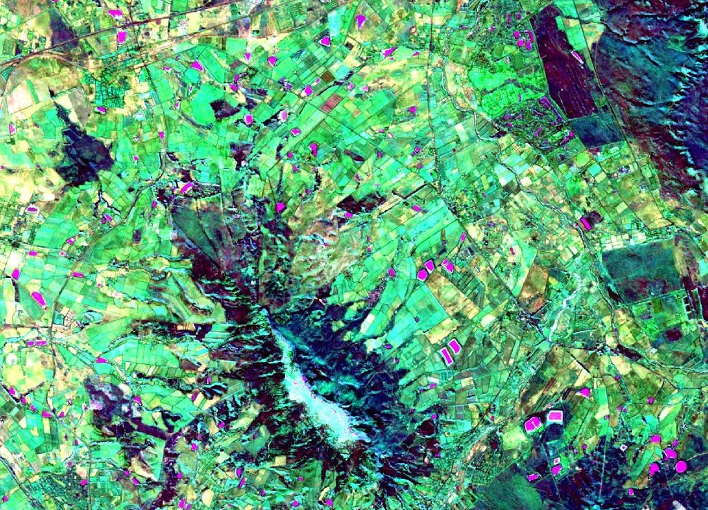
Vegetation and Water Features
Highlight these using the infrared spectrum with Geomedian – SWIR, NIR, Green.
Annual Change Metrics
Visualise changes using Median Absolute Deviations (SMAD, EMAD, BCMAD) or focus on arid land variation with desert-specific MADs.
Green Vegetation
Identify areas with the Normalised Difference Vegetation Index (NDVI – Red, NIR).
Water Bodies
Locate water features using indices like NDWI (Green, NIR) or MNDWI (Green, SWIR).
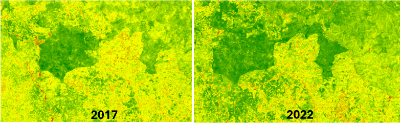
Water Quality
Assess chlorophyll levels using the Normalised Difference Chlorophyll Index (NDCI Red Edge, Red) with Sentinel-2 GeoMAD products.
Digital Earth Africa
GeoMAD
With GeoMAD, satellite data becomes a powerful resource for exploring landscapes, tracking environmental changes, and making informed decisions.
For more information about GeoMAD, view the product details on Digital Earth Africa Docs or explore the Map.
Related Use Cases
November 19, 2024
Keeping a watchful eye on landscape changes with the Rwandan Forest Authority