English
  Português
  Français
  العربية
 Digital Earth Africa
Fractional Cover
A Powerful Analysis Service Describing the Landscape
Digital Earth Africa’s Fractional Cover is a Continental Service that describes the landscape in terms of coverage by green vegetation, non-green vegetation, and bare soil. It provides insight into how proportions of each have changed over time, demonstrating, for example, where vegetation has been removed or died with a shift to bare earth, often indicative of declining landscape health.
By providing estimates of the proportion of bare, green and non-green cover on the Earth’s surface from 1984 to the present, the Service is a powerful tool to support assessment of agricultural activities, environmental conditions, and changes in vegetation over the past decades.
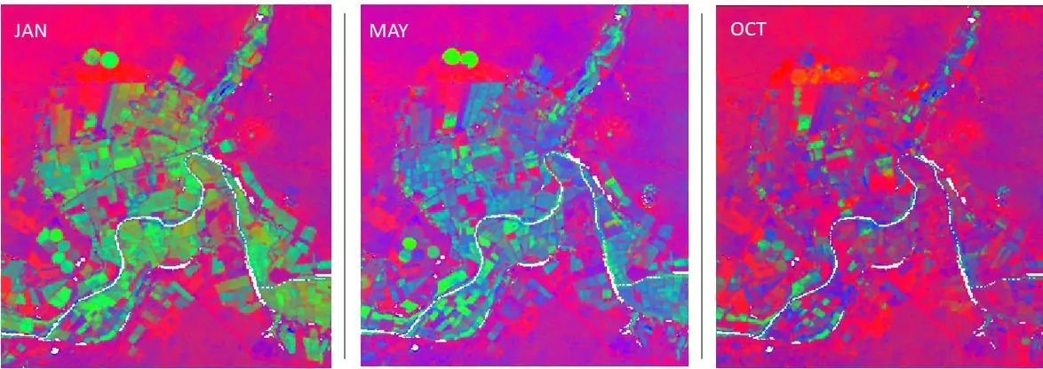
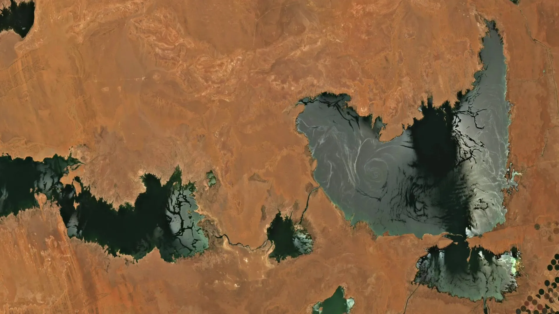
Fractional cover Olifants River , Koekenaap, South Africa with 5 month intervals captured 2017 processed by Digital Earth Africa.
Key Features
Two Key Components
Includes Fractional Cover, which is estimated from each Landsat scene, providing measurements from individual days, and a Fractional Cover Annual Summary, which provides 10th, 50th, and 90th percentiles estimated independently for the green vegetation, non-green vegetation, and bare soil fractions observed over a calendar year.
Decades of Change
Made available from the 1980s to the present, changes in vegetation status over decades can be analysed enabling long-term comparisons of environmental conditions. The service predicts vegetation cover at 30m per pixel and has coverage across the continent of Africa.
Designed for Land Management
Extensive spatial coverage at a high spatial resolution combined with the historical archive supports identification of large-scale patterns and trends. The Service is targeted at enabling policy agencies, land managers and scientists to monitor land conditions over large areas and long timeframes.
An example of Fractional Cover Analysis of the Olifants River
A series of Fractional Cover images over 10 months at 5-month intervals reveal the changing landscape near Olifants River, Koekenaap, South Africa.
The analysis highlights:
A growing season with increasing green areas. The transition to brown and bare earth after harvest. This data supports multi-year comparisons of land management practices and seasonal trend analyses.
Applications
Erosion Risk and Soil Carbon Dynamics
Evaluating areas prone to wind and water erosion while monitoring changes in soil carbon over time.
Land Management Practices
Supporting decisions on crop rotation, stubble management, and rangeland management giving insights into not only vegetation, soil and water, but also land, crop and grazing management.
Vegetation Monitoring and Management
Analysing vegetation health and changes, track the success of interventions including restoration activities.
Fire Risk Assessment
Estimating fuel loads to assess potential fire hazards.
Ecosystem Modelling
Contributing to predictive ecosystem models; provides input to analyses such as wetland insights and land management.
Rangeland Condition
Assessing and managing rangeland health.