 English
  Português
  Français
  العربية
 Digital Earth Africa
Coastlines Service & Dashboard
Protecting coastal communities and infrastructure
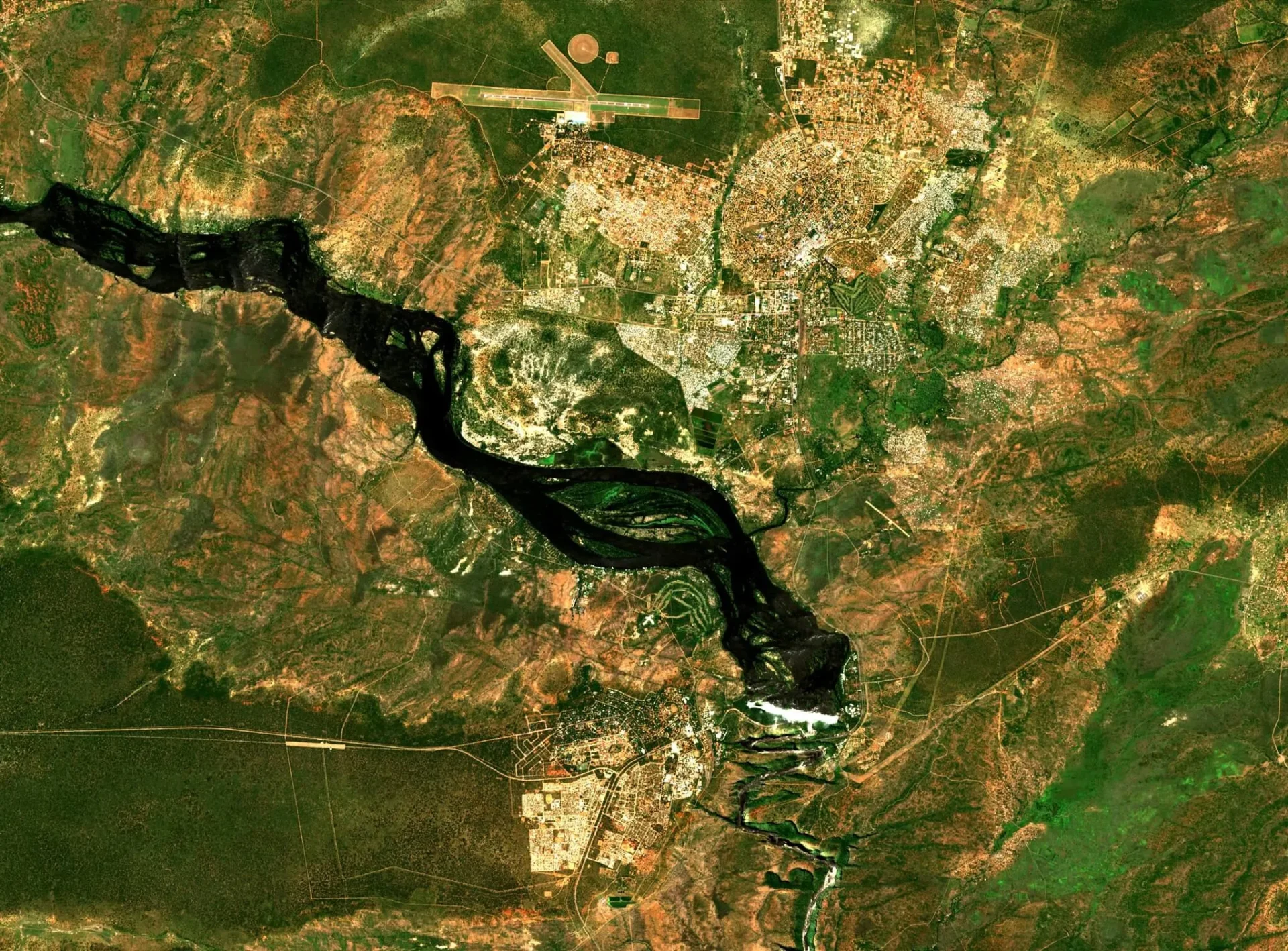
The Digital Earth Africa Coastlines Monitoring Service combines satellite data with tidal modelling to map the shoreline location and the average sea level tide each year. By providing information on annual shoreline positions and rate of change along the entire African coastline, this unique Service enables trends of coastal erosion and growth to be examined annually at both local and continental scales and identify hot spots of coastlines at risk of significant change.
Available from the year 2000 onwards, patterns of coastal change are updated annually as data continues to be acquired. This allows current rates of change to be compared with that observed in previous years or decades. The ability to map shoreline positions for each year provides valuable insights into whether changes to the coastline are the result of particular events or actions, or a process of more gradual change over time. The monitoring service is a valuable resource for evaluating the impact of coastal management, as well as modelling responses to changing conditions such as extreme weather events and human development.
As a companion to the Coastlines Monitoring Service, the Coastlines dashboard (below) is an easy-to-user service that provides at-a-glance national scale summaries for each African country with a coastline. By providing detailed, country-specific data, the service supports the identification of at-risk communities, infrastructure, and settlements, guiding targeted interventions and informing national coastal adaptation needs.
Key Features
Explore powerful tools and comprehensive data to monitor, analyse, and understand changes along Africa’s coastline over the past 24 years.
Comprehensive Coverage
Annual shorelines and rates of change statistics are provided along the entire African coastline at a 30m spatial resolution. Satellite data from 2000 to near real-time helps users pinpoint past and present coastline locations, monitor the rate of change, and detect at-risk areas.
Accurate Modelling
Integrates satellite data with tidal modelling to map representative shoreline locations and average sea levels annually, and with measures of uncertainty provided.
Continental & Local Insights
Analyse coastal retreat and growth at both local and continental scales to drive effective coastal management. Track and analyse the impact of natural and human-induced changes, such as extreme weather events and human development.
Applications
- Monitor and map coastal erosion across Africa.
- Assess the impact of local and regional coastal management based on historical data.
- Identify communities and infrastructure at risk from coastal erosion
- Model coastal responses to sea-level rise, extreme weather, and human development.
- Support studies on the causes and effects of coastline changes over time.
- Identify adaptation actions and inform national plans.
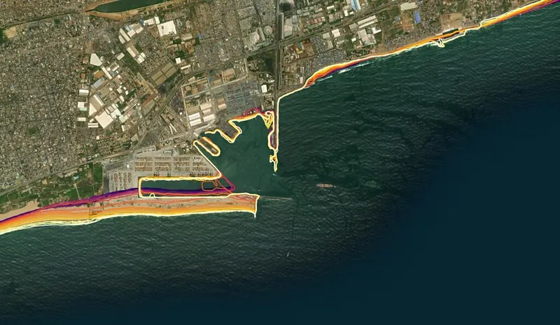
A StoryMap of Saly Portudal, Senegal
In support of Senegal’s National Adaptation Plan, Digital Earth Africa and partners including the The Centre de Suivi Écologique (CSE) in Senegal are using Earth observation data and DE Africa’s Coastlines Service to better understand coastal impacts from weather, changing climate, and expanding human population.
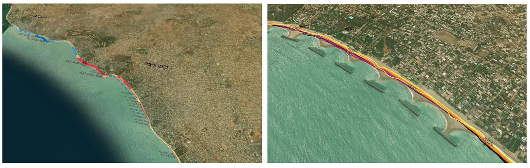
Overview of rate of coastal change in Saly Portudal including the Saly Portudal breakwaters.
Related Use Cases
March 26, 2026
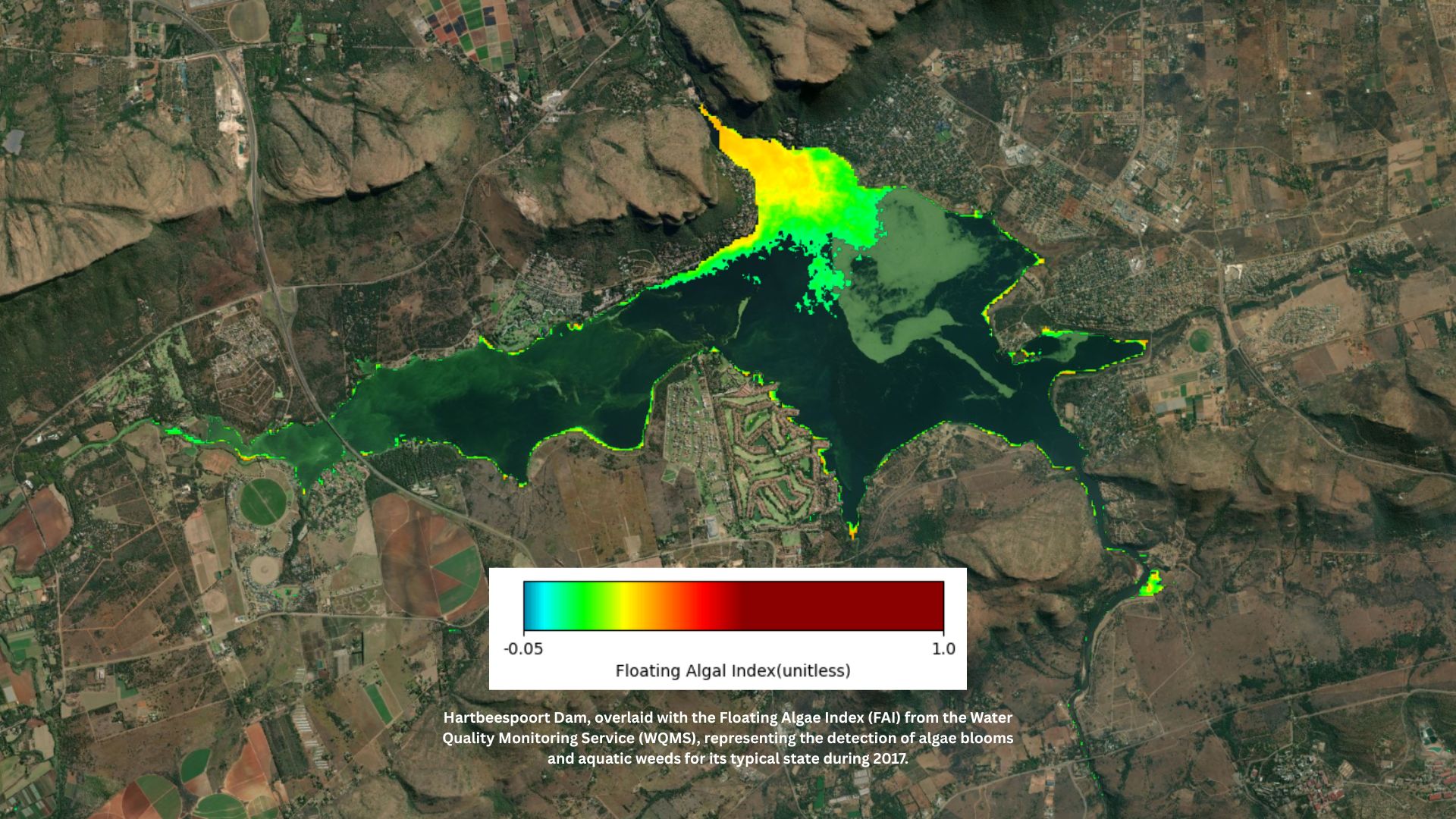
Digital Earth Africa launches continental Water Quality Monitoring Service to strengthen evidence-based water management

March 5, 2026
Championing the next generation of African geospatial talent: A conversation with Nancy Wayua