 English
  Português
  Français
  العربية
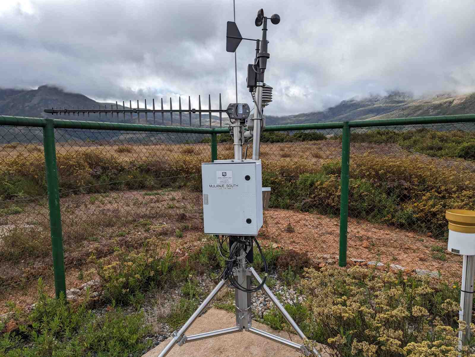
Africa’s mountain regions are vital for supplying freshwater to downstream communities, supporting rare and endemic species, and regulating local microclimates that influence agriculture and weather patterns. However, many of these areas are underrepresented in environmental monitoring systemsnetworks, making it difficult to fully understand their dynamics or manage their resources effectively.
To help address this gap, DE Africa worked with the African Mountain Research Foundation (AMRF) to explore how open-access Earth observation data can be integrated with local, in-situ datasets to enhance understanding of these sensitive environments. As part of this collaboration, the team developed a Jupyter Notebook that demonstrates a workflow to compare and validate temperature data from DE Africa with weather station data from AMRF. The notebook provides a method to assess the differences between satellite-derived and in-situ temperature data and helps users understand how both data sources can be used together effectively.
The African Mountain Research Foundation is dedicated to improving the understanding and sustainable management of Africa’s mountain ecosystems through scientific monitoring and research. The organisation focuses on high-altitude landscapes that are ecologically and hydrologically significant, yet often lack consistent data collection. AMRF currently operates weather stations in mountain ranges such as Mount Mulanje in Malawi, the Eastern highlands in Zimbabwe, and the Drakensberg mountains in southern Africa. These stations collect critical in-situ environmental data such as temperature, solar irradiance, wind speed, rainfall, and humidity, which can be used for ecological modelling, early warning systems, and climate change adaptation planning.
A key case study featured in the notebook is Mount Mulanje, which is known for its ecological significance and role as a major water catchment. Using 2024 data collected from AMRF’s weather stations on the mountain, the notebook compared observed air temperatures with spatially modelled estimates derived from Earth observation sources. The results showed an average difference of five degrees Celsius in air temperature, underscoring the importance of localised measurements for improving the accuracy of spatial models in mountainous areas. At the same time, it highlighted the value of Earth observation data in extending coverage to areas where on-the-ground data is limited or absent.
Clara Hickman of AMRF notes that a major challenge facing researchers is the lack of consistent, high-quality observational data across Africa’s mountainous systems. “There are significant gaps, what we call ‘black holes’ in the data, particularly in highland areas. Integrating Earth observation with field-based data is one of the most promising ways to address this.”
The collaboration demonstrates how DE Africa’s datasets which are accessible, analysis-ready, and cover the entire African continent, can be used in combination with user-supplied data. The workflow shown in the notebook can run in any computing environment, enabling researchers and practitioners to replicate or adapt it with their own datasets. This lowers the barrier to entry for organisations that may not have access to sophisticated infrastructure or cloud services.
This collaboration sets an important precedent for open, reproducible research methods that help unlock insights in under-observed regions. By combining tools and data in an accessible way, DE Africa and AMRF are helping to bring mountain ecosystems, often overlooked in broader policy and scientific efforts, into clearer focus.
Explore the open-access notebook: African Mountain Validation Notebook