 English
  Português
  Français
  العربية
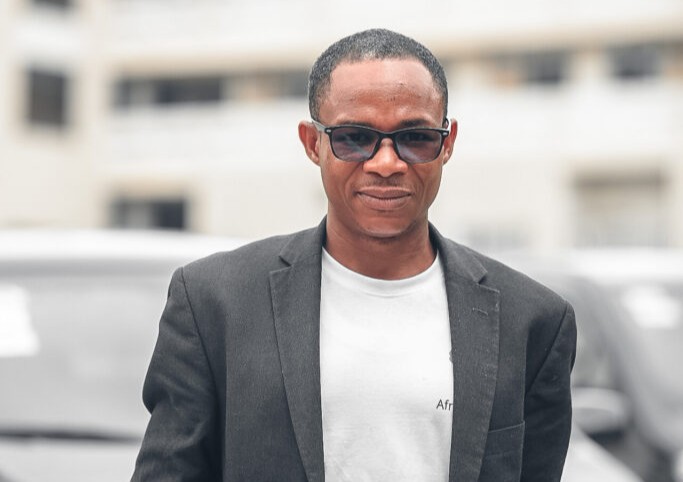
As universities across Africa seek new ways to equip students with practical geospatial skills, partnerships with platforms like Digital Earth Africa are helping bridge the gap between theory and real-world application. At Ho Technical University in Ghana, Dr Benjamin Wullobayi Dekongmen is doing exactly that by introducing students and colleagues to the possibilities of Earth observation data in teaching, research, and decision-making.
A lecturer in Agricultural Engineering with a research focus on geospatial hydrology, Dr. Dekongmen recently hosted a Digital Earth Africa training session at the university. The training aimed to expose students to open-access satellite data and analytical tools that extend far beyond traditional GIS classroom exercises. In this feature, he reflects on how the collaboration began, what stood out during the training, and why Earth observation is becoming essential for the next generation of researchers and engineers in Africa.
Can you briefly introduce yourself and your role at your institution?
I am Dr. Benjamin Wullobayi Dekongmen, a Lecturer in the Department of Agricultural Engineering at Ho Technical University, Ho, Ghana. I teach courses in GIS and Remote Sensing, Water Resources and Hydrology, Climate Change, and Water and Sanitation Engineering, among others. My research focuses on geospatial hydrology, including flood modelling, groundwater recharge modelling, the application of machine learning in water resources, and climate change.
What first drew you to earth observation and geospatial technologies?
My research in geospatial hydrology sparked a strong interest in earth observation, driven mainly by the availability of open-access datasets that help address the challenge of data scarcity. Geospatial technologies play a significant role in supporting research in geospatial hydrology, which remains my core area of focus.
How did the collaboration between your institution and Digital Earth Africa begin?
As a frequent user of DE Africa resources, I wanted to share these opportunities with my institution, particularly with students enrolled in GIS, Remote Sensing and related courses. The collaboration began through communication between Dr Kenneth Mubea and me.
What motivated you to organise the recent DE Africa training at your university?
It is important to expose students to opportunities beyond conventional in-class lectures, take-home assignments, and semester projects. Students should develop awareness of the advanced knowledge, skills, real-world applications, and opportunities associated with courses such as GIS and Remote Sensing.
The training therefore served as a bridge between theoretical instruction and practical application, while also motivating students to engage more seriously with the course material.
What stood out to you most from the training sessions, particularly in terms of student engagement or institutional interest?
A few colleagues who participated were amazed by DE Africa’s rich resources. Before this training, students had limited awareness of such advanced tools, as their perception of GIS and Remote Sensing was largely confined to basic map creation within ArcGIS or QGIS environments.
The training has since generated considerable institutional interest, and there are plans to organise a series of similar training sessions, especially for staff in the Departments of Agricultural Engineering and Civil Engineering.
How do you see Digital Earth Africa supporting teaching, research, and curriculum development at your institution, especially at postgraduate level?
Digital Earth Africa stands out as a vital partner and platform that bridges the gap in theoretical teaching in today’s innovative academic environment. DE Africa will critically support teaching and research, and most importantly, curriculum development and accreditation.
Postgraduate students will not only learn about DE Africa but will also conduct their studies using the platform and its resources. Additionally, the opportunity to collaborate with DE Africa could help facilitate the accreditation of courses such as GIS and Remote Sensing, precision agriculture, and related programmes.
In your view, how can earth observation data strengthen evidence-based decision-making in your country, particularly in areas such as agriculture, water resources, urbanisation, or climate adaptation?
Observed datasets are scarce in the country, and over the years Earth observation data have been effectively and consistently applied in our research, particularly in agriculture, water resources, urbanisation, and climate adaptation.
What challenges do universities in your country face in integrating geospatial and EO tools into teaching and applied research?
Universities face several challenges when integrating geospatial and EO tools into teaching and applied research.
Firstly, each course is allocated a fixed number of credit hours within a semester, and some semesters are relatively short within the academic calendar. This makes it difficult for lecturers to complete course content while also exposing students to the extensive resources offered by geospatial and EO tools.
Secondly, some students enrolled in courses such as GIS and Remote Sensing may not have access to a functional laptop or personal computer, which can hinder effective participation. Furthermore, not all universities have dedicated computer laboratories equipped for such programmes or courses.
However, platforms such as DE Africa often ease some of these challenges for both lecturers and students.
What advice would you give to students and young professionals who are interested in building careers in earth observation?
I would strongly encourage students and young professionals to leverage open-access resources and online courses to gain relevant knowledge and skills. Platforms such as DE Africa, among others, offer readily available learning opportunities that may not necessarily be provided within institutional settings. Taking advantage of such resources is essential for building a competitive and well-rounded foundation in earth observation.
Looking ahead, what would a successful long-term partnership between your institution and Digital Earth Africa look like?
A successful long-term partnership between our institution and Digital Earth Africa would include curriculum enhancement and expanded application of EO data and geospatial technologies across agricultural engineering, environmental engineering, and civil engineering research and teaching. It would also ensure greater accessibility to DE Africa resources for students’ practical activities.
Furthermore, in-person workshops could be initiated to foster wider community participation and build capacity in Earth observation and geospatial technologies among researchers, lecturers, and both undergraduate and postgraduate students.
It is equally anticipated that a Memorandum of Understanding (MoU) would be formalised between our institution and Digital Earth Africa to ensure that the full potential of the platform’s resources is realised within our institutional context. As partners, such an MoU could support joint projects and collaborative grant proposals, contributing to the achievement of the Sustainable Development Goals across the continent.