 English
  Português
  Français
  العربية
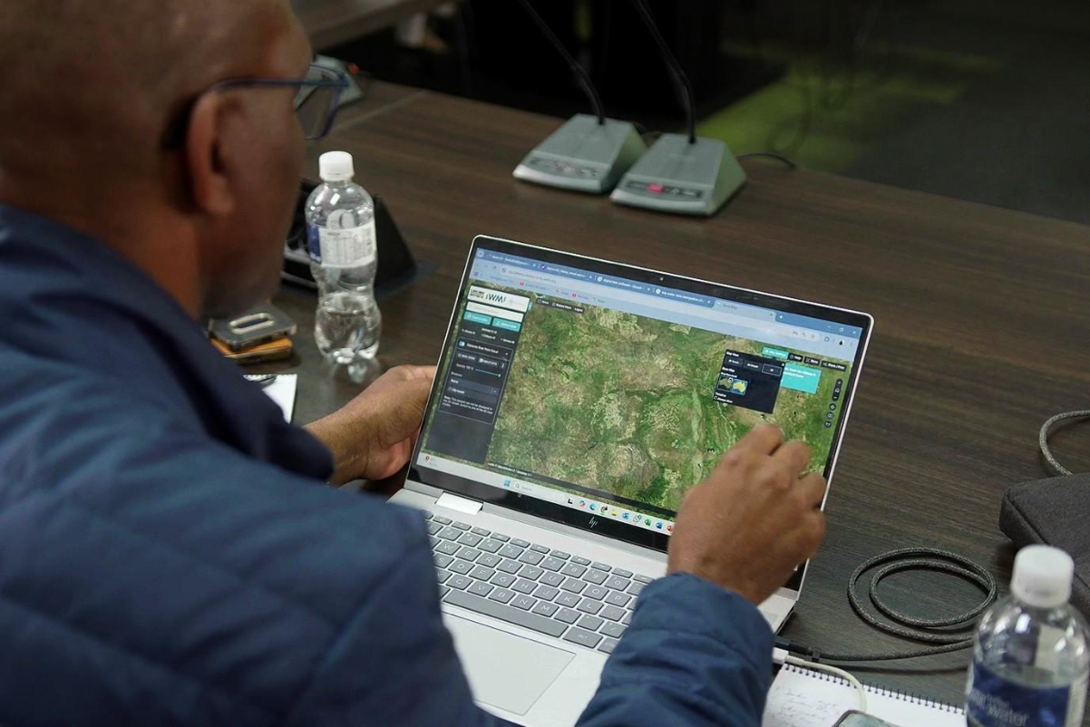
IWMI and Digital Earth Africa are supporting water managers from the Limpopo River Basin by improving access to better data and more accurate water level estimates.
By Sam Storr, Surajit Ghosh and Mariangel Garcia
Across Africa, farmers rely on water from dams to irrigate their crops through periods of drought. But how much water is stored in the dam? Farmers and water managers often do not have this critical information. To address the challenge, IWMI researchers have worked with Digital Earth Africa (DE Africa) to create an innovation that uses satellite images and AI to get timely and accurate dam volume measurements, with the potential to transform reservoir management in southern Africa.
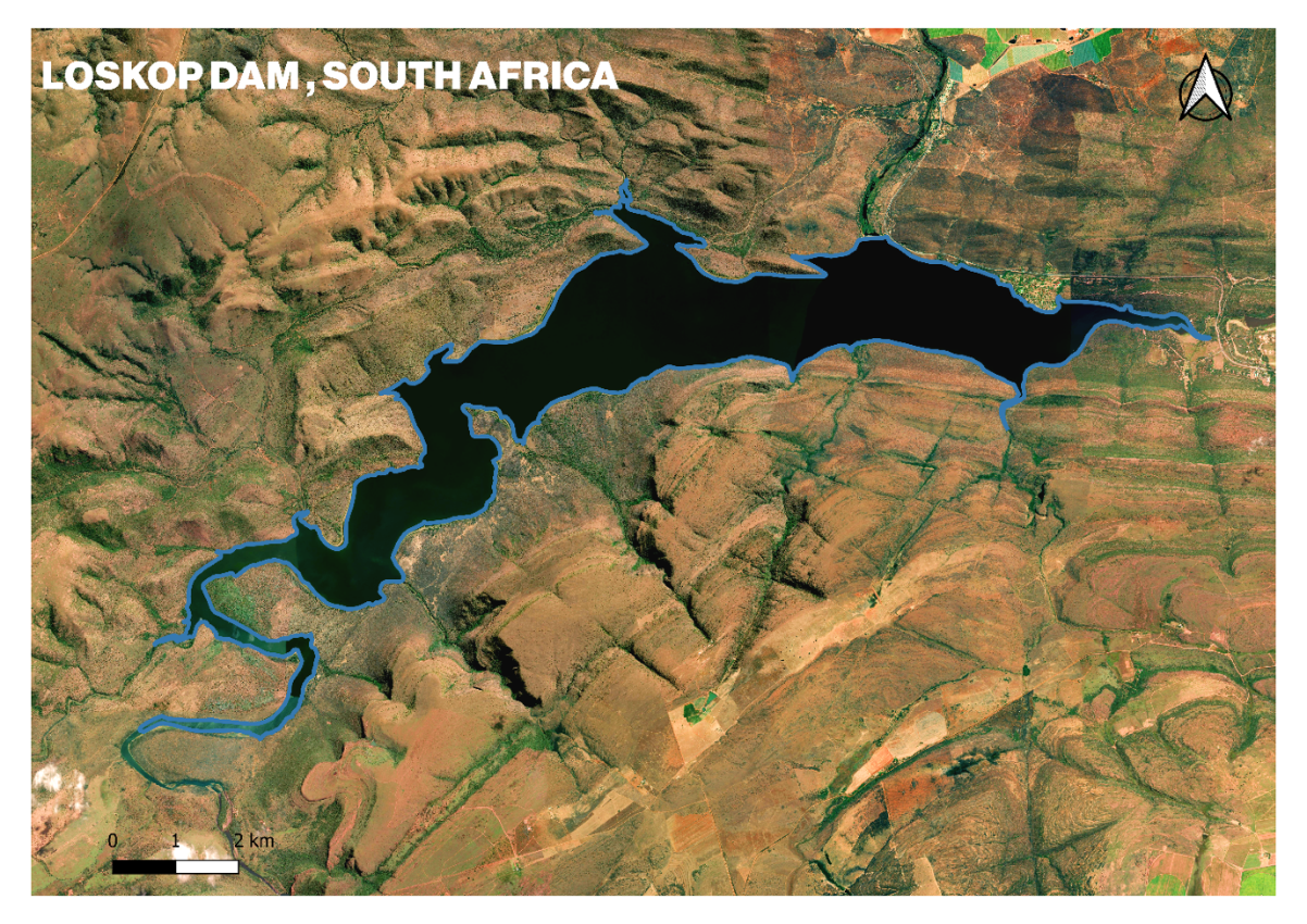
In the heart of South Africa, the Loskop Dam supplies irrigation to over 25,000 hectares of farmland. In a region where rainfall is inconsistent and demand is high, uncertainty in dam volume estimation can ripple out into agricultural stress, crop failure and conflict over resources. Traditional field-based measurement methods, while helpful, are often sparse, delayed and logistically limited.
Thanks to a collaborative process between LIMCOM, the CGIAR Accelerator for Digital Transformation, IWMI’s Digital Twin, which is housed under the Digital Innovations for Water Secure Africa (DIWASA) project, and DE Africa, water levels dams such as Loskop will no longer be a mystery.
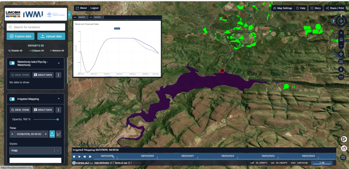
Estimating water levels using satellite imagery and machine learning
The innovation uses satellite images showing the amount of visible surface water in a dam over time and the known geometry of the dam itself, both of which are needed to estimate the amount of water in the dam. A mix of several machine learning models predict water level estimates with a higher level of accuracy compared to just field measurements. To achieve high accuracy, the method switches between different models to calculate water volume at different dam levels.
The innovation is already being applied in real-world water management systems, such as the Limpopo Digital Twin project*. The Limpopo Digital Twin has been adopted by water managers in the Limpopo River Basin who use the virtual representation of the entire Limpopo River basin for decision-making. Uneven water monitoring capacity among the four countries in the Limpopo River basin is a major obstacle to creating an accurate hydrological model of the basin. New sources of data developed from a mixture of satellite images and machine learning go a long way to filling gaps in monitoring capacity.
When technological innovation meets data democratisation
This innovation shows how open access data can catalyse real world impact, creating a way to track water availability in remote areas with minimal need for investment in data gathering, processing and field monitoring. With this data, the researchers could focus on developing methodologies that are now easily available for other users such as government water authorities, researchers and NGOs to adapt to more reservoirs and dams.
The surface water datasets were derived from Landsat satellite imagery by DE Africa and made freely accessible on a cloud platform. DE Africa is a pan-African, digital data infrastructure for accessing and analysing satellite imagery specific to Africa and is used extensively by stakeholders throughout the continent. DE Africa draws on more than three decades of satellite imagery to address critical challenges facing the African continent and packages Earth Observation (EO) data into accessible and open data sets.
The innovation methodology was made publicly available in an interactive Jupyter Notebook on the DE Africa platform. This notebook serves as both a learning resource and a practical tool, demonstrating how machine learning and EO data can be combined to generate accurate dam volume estimates in regions with limited in-situ measurements. Users can adapt and apply this workflow to their own reservoirs with minimal coding and infrastructure requirements.
Beyond estimating water availability in reservoirs, the combination of machine learning, earth observation data and cloud computing platforms provides a model to develop further solutions for resilient water governance in a climate-stressed world. With platforms like DE Africa providing open access to analysis-ready satellite data, and organizations like IWMI bringing decades of water management expertise, the continent is well-positioned to leapfrog into a data-driven future.
*The Limpopo River Basin Digital Twin project was the Limpopo Watercourse Commission (LIMCOM) under the Global Environment Facility’s Small Grants Program (UNDP-GEF). As part of the CGIAR Accelerator for Digital Transformation, IWMI aims to harness state-of-the-art technologies to enhance water management in the Limpopo River Basin alongside technology partners such as DE Africa and Amazon Web Services, supported by the Leona M. and Harry B. Helmsley Charitable Trust