 English
  Português
  Français
  العربية
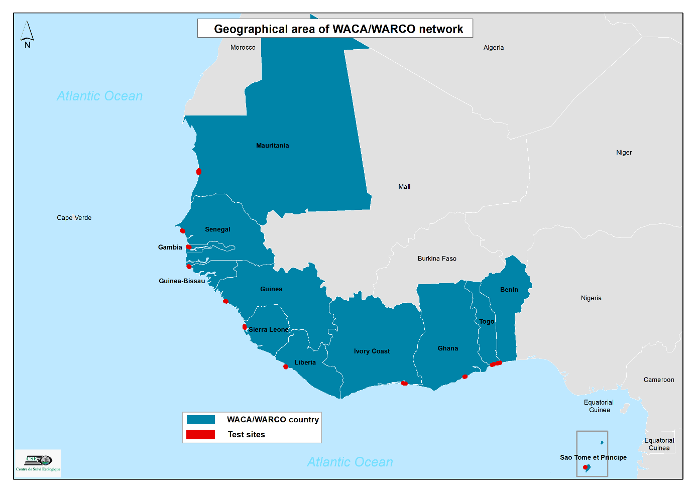
Coastal regions are vital to the livelihoods, economies, and ecosystems of millions across Africa. Yet, these areas are among the most vulnerable to the impacts of erosion, flooding, and rapid environmental change. As coastlines shift, so does the stability of communities, infrastructure, and habitats that depend on them. Reliable, up-to-date data is essential to help decision-makers understand and respond to these changes effectively.
In November 2023, experts from 12 West African countries gathered in Saly Portudal, Senegal, for a capacity-building workshop, a key milestone in strengthening coastal monitoring across the region. The training, co-organised by the Centre de Suivi Écologique (CSE) and Cerema under the West African Regional Coastal Observatory (WARCO), introduced participants to the use of satellite data and field tools for tracking coastal change.
Building capacity with Digital Earth Africa’s Coastlines Service
A key highlight of the workshop was the introduction of Digital Earth Africa’s Coastlines Service, a freely accessible tool that uses Earth observation data to monitor coastal change across the continent. The service provides insights into erosion trends and shoreline movement, helping coastal managers make informed decisions.
Over 30 participants, including 24 technical staff from WACA member countries, were trained on how to use the Coastlines Service through both the interactive map interface and the Sandbox coding environment. Using Saly Portudal as a case study, participants explored how satellite data can be combined with field observations to validate and strengthen coastal monitoring at national levels.
Dr. Moussa Sall from CSE emphasized the importance of harmonizing methodologies across the region, noting that coupling field-based observations with Earth observation data is key for effective and accurate coastal management. Regular training and knowledge exchange between national and regional observatories, he added, will be crucial for sustained impact.
Linking field data with satellite insights
Participants also gained hands-on experience with Cerema’s Scout tool, which supports field data collection for post-flood assessments. Through fieldwork conducted in Saly Portudal, the team demonstrated how combining datasets such as building footprints and population information can help map vulnerabilities and guide preventive action. Despite existing protection measures, Saly Portudal remains at risk of erosion and flooding, underscoring the need for continued monitoring and data-driven planning.
Participants expressed strong appreciation for the practical nature of the training and the accessibility of the DE Africa Coastlines tool. Many called for continued workshops, both virtual and in-person, to ensure ongoing capacity building and data sharing across the region. They also highlighted the value of multilingual inclusivity, suggesting that future engagements include translation for Portuguese-speaking countries to enhance collaboration.
Expanding data applications across sectors
Beyond coastal monitoring, the partnership between CSE, Digital Earth Africa, and the SERVIR program is enabling new applications of Earth observation data in agriculture and land management. Using the DE Africa Sandbox, CSE produced crop maps for 2020 and 2023 that have proven valuable for SERVIR’s food security work in Senegal. Building on this success, a new round of training is empowering SERVIR’s community of practice to create their own crop maps and strengthen national agricultural monitoring efforts.
This collaboration has also reached key institutions, including the Senegalese Institute of Agricultural Research (ISRA), FAO, the Directorate of Agriculture, and the Agricultural Bank, promoting the wider use of Earth observation tools for sustainable agriculture and food security.
Monitoring land degradation with DE Africa tools
At the GEO-LDN Regional Dialogue Forum for French-speaking countries, participants explored how DE Africa tools can also help track land degradation indicators, including land cover change and vegetation health. Using satellite-derived data and NDVI analysis, the session illustrated how users can easily observe changes such as deforestation and urban expansion. The demonstration showcased how accessible data from DE Africa can support national efforts toward achieving Land Degradation Neutrality.
From the shores of Saly Portudal to the farmlands of Senegal, Digital Earth Africa continues to empower African experts with the data and skills they need to understand and respond to environmental change. Through these partnerships, countries across the continent are building the capacity to manage their natural resources sustainably, using the power of Earth observation for the benefit of all.