English
  Português
  Français
  العربية
 Transforming Earth Data into Insights for Africa's Sustainable Growth
Digital Earth Africa aims to deliver decision-ready products using Earth observations to address social, environmental, and economic challenges in Africa. We process open data to meet the continent’s needs to enhance capacity and foster innovation across sectors.
Digital Earth Africa exists to improve the lives of people across the African continent by translating Earth observations into insights that will support sustainable development.
Our mission is to process openly accessible and freely available data to produce decision-ready products. Working closely with the AfriGEO community, Digital Earth Africa is responsive to the information needs, challenges, and priorities of the African continent. Digital Earth Africa leverages and builds on existing capacity to enable the use of Earth observations to address key challenges across the continent.
Digital Earth Africa
Our Mission
Our vision is to provide a routine, reliable and operational service, using Earth observations to deliver decision-ready products enabling policy makers, scientists, the private sector and civil society to address social, environmental and economic changes on the continent and develop an ecosystem for innovation across sectors.
Digital Earth Africa
Our Vision
Unlocking the Power of Satellite Data
Digital Earth Africa transforms decades of satellite images into decision-ready insights, empowering sustainable development, resource management, and climate resilience.
Explore Africa’s landscapes and resources with our suite of tools. From the user-friendly DE Africa Map to advanced dashboards, metadata explorers, and OGC web services, our platform empowers users to access, analyze, and share data. Collaborate with others via notebooks and our Slack channel, and unlock the potential of geospatial insights tailored for Africa.
Digital Earth Africa
Platform
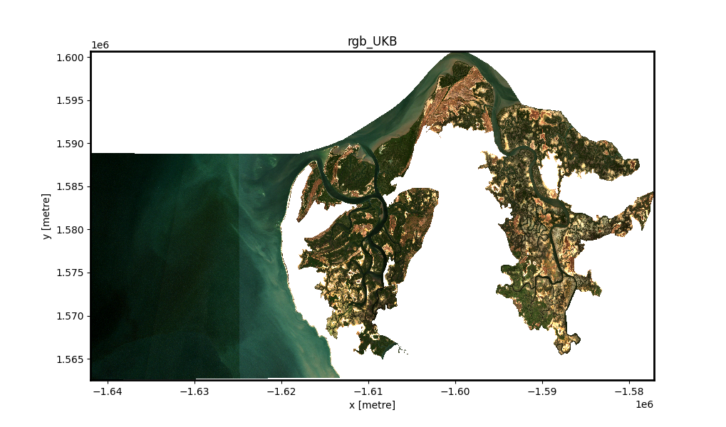
Gain powerful insight through the use of Digital Earth Africa’s continental-scale, analysis-ready Earth observation data which incorporates historical to near-real time data on Africa’s coastlines, waterbodies and land expanse.
Digital Earth Africa
Services
Obtain a sound understanding about the significance of Earth observations through the online learning platform, by exploring Digital Earth Africa datasets via Digital Earth Africa’s interactive map and getting started on the basics of python coding for spatial analysis.
Digital Earth Africa
Online Learning

Satellite Data for Sustainable Development
Digital Earth Africa provides analysis-ready satellite data to support actionable insights that meet Africa’s environmental and socio-economic needs.

Enabling Climate Action
Digital Earth Africa enables high quality continental, country and local scale analyses to produce and mobilise appropriate climate action.

Agriculture & Food Security
In light of accelerating food needs in Africa, Digital Earth Africa’s range of analysis tools help address agriculture and food security issues at a local, regional and continental scale.

Land Degradation & Coastal Erosion
Digital Earth Africa’s interactive vegetation, waterbodies and coastline data services enable land quality and coastline change monitoring.

Urbanisation
Digital Earth Africa provides an accessible and accurate means of mapping the urban extent of cities, to support urban management.

Water Resources & Flood Risks
Digital Earth Africa’s continental services map and visualise surface water, understanding water trends over time, to reduce flood risks and identify water scarcity hotspots.
Impact Stories
May 15, 2025
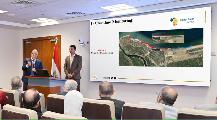
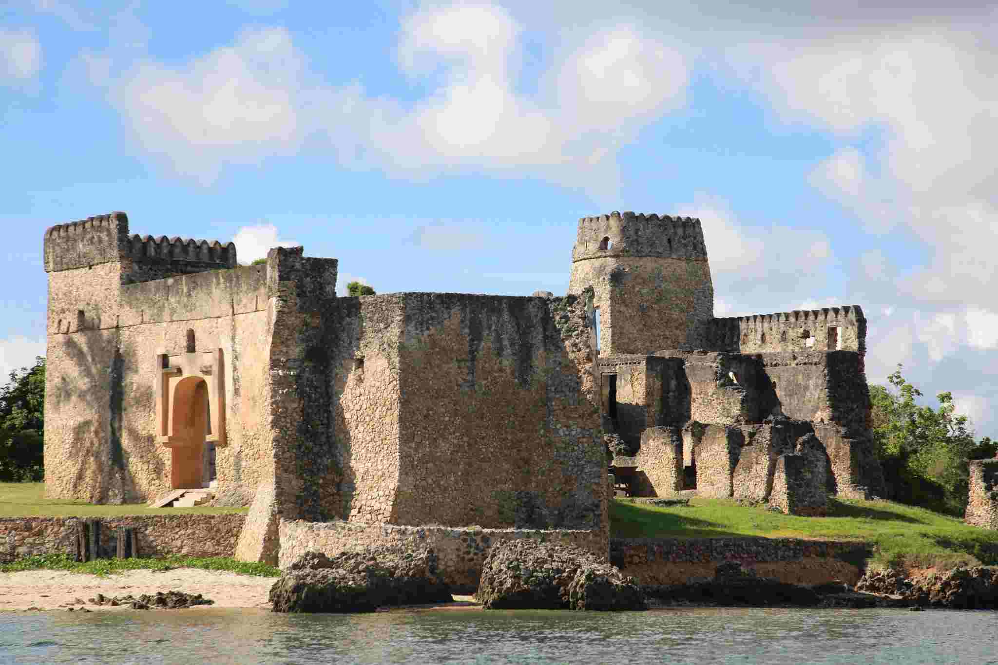
Mapping the Coast to Save the Past: Satellite Data Supports Cultural Heritage in Africa